Map of La Crosse, Wisconsin
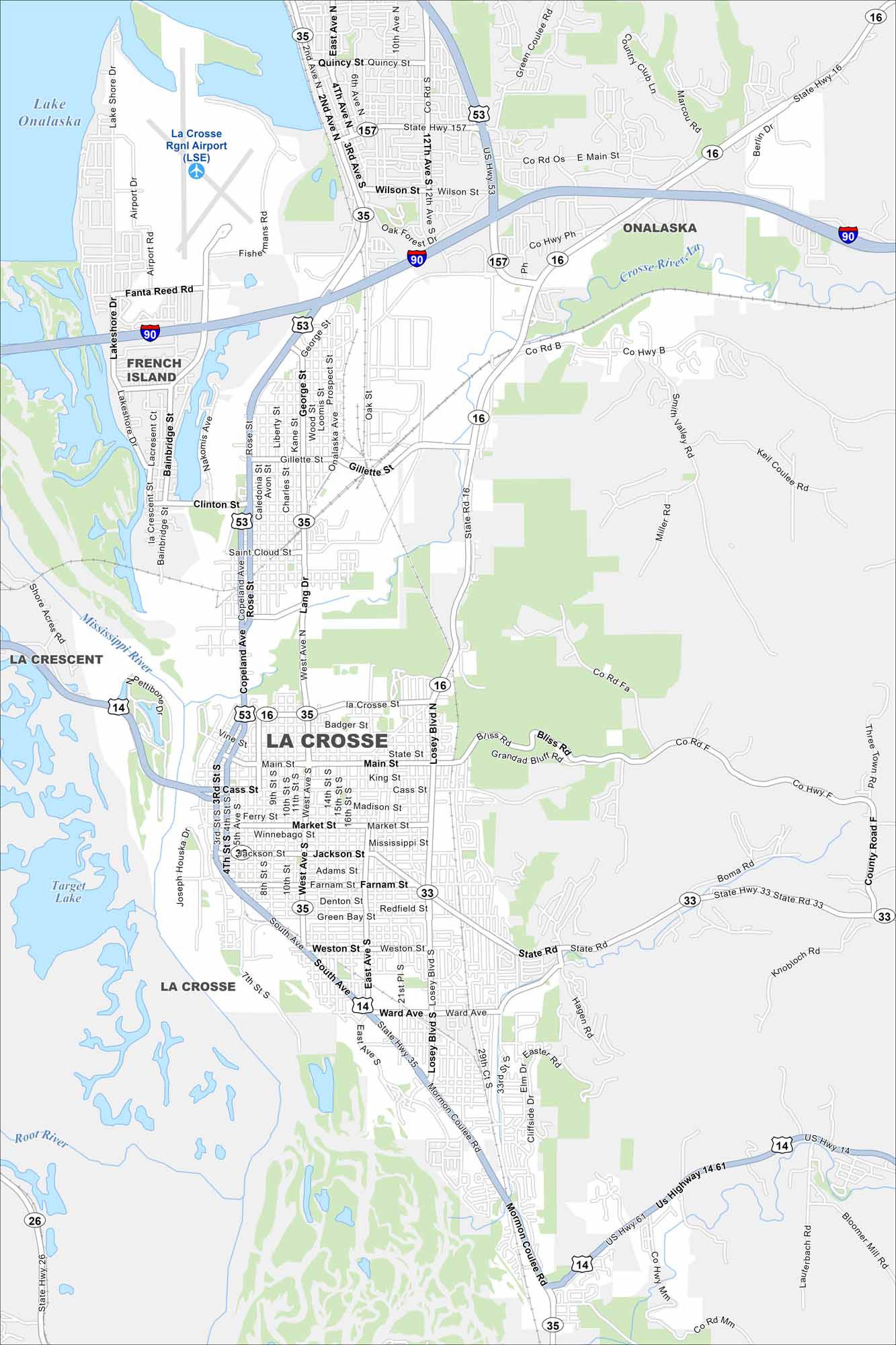
La Crosse is perched along the Mississippi River. Our map highlights bluffs rising from the riverbanks. Downtown clusters right at the river’s edge.
Map Information
On the Map
Interstates/Highways: I-90, US Hwy 53, US Hwy 14, US Hwy 61, State Rte 157, State Rte 35, State Rte 33, State Rte 16, State Rte 26 Major Roads: Losey Blvd, George St, Main St, Cass St, State St, West Ave, 3rd St, 4th St, Mormon Coulee Rd, Ward Ave, Green Bay St, Palace St, Clinton St, Gillette St, River Valley Dr, Lang Dr, Copeland Ave, 16th St, Bainbridge St, Lakeshore Dr Airports: La Crosse Rgnl Airport Lakes and Reservoirs: Lake Onalaska, Target Lake Major Rivers: Mississippi River, Black River, Root River, La Crosse River Nearby Communities: Onalaska, French Island, La CrescentWisconsin State Maps
Discover maps of the Badger State.


City Maps of Wisconsin
See our Wisconsin maps designed for clarity.


