Map of Knoxville, Tennessee
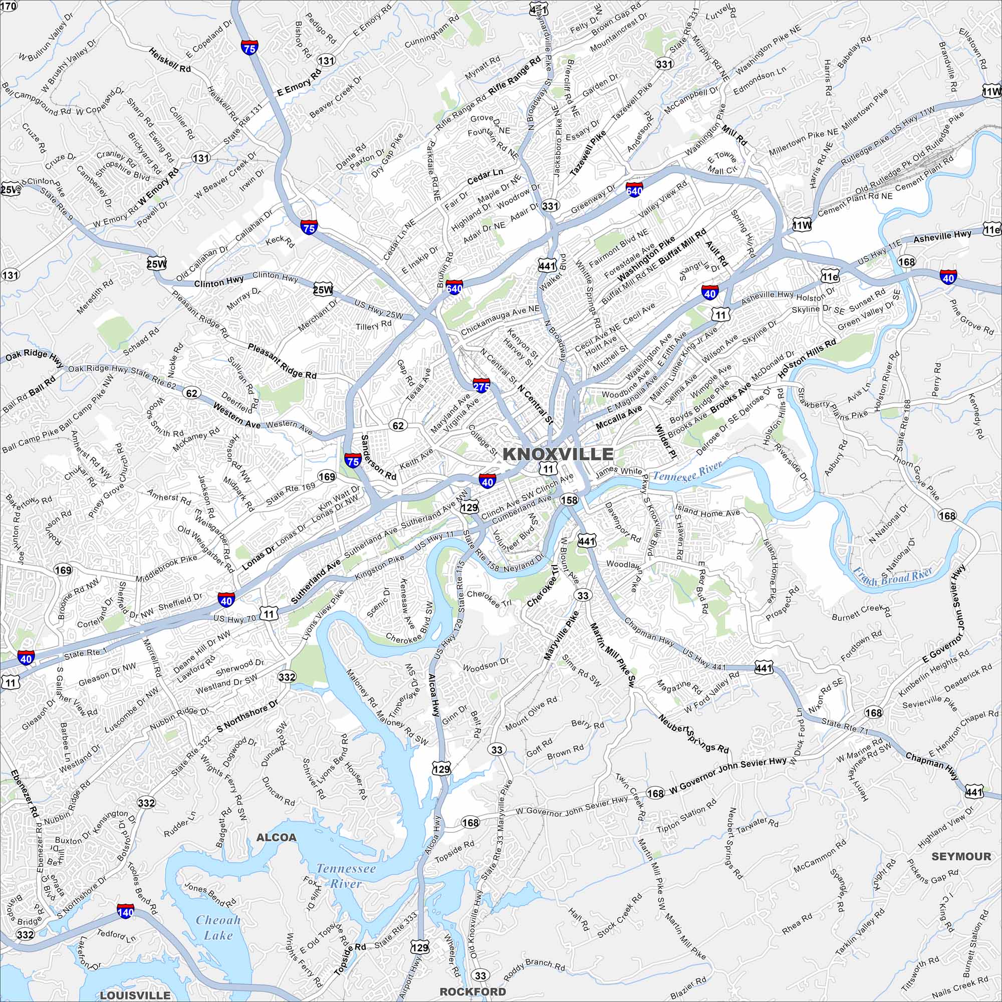
Check out our map of Knoxville with Tennessee River as a key feature. Downtown sits near the river’s bend. The Great Smoky Mountains loom to the southeast.
Map Information
On the Map
Interstates/Highways: I-40, I-75, I-140, I-275, I-640, US Hwy 11, US Hwy 11E, US Hwy 11w, US Hwy 25w, US Hwy 70, US Hwy 441, State Rte 1, State Rte 33, State Rte 62, State Rte 71, State Rte 129, State Rte 131, State Rte 158, State Rte 168, State Rte 169, State Rte 331, State Rte 332, State Rte 333 Major Roads: Kingston Pike, Broadway, Chapman Hwy, Magnolia Ave, Western Ave, Clinton Hwy, Asheville Hwy, Northshore Dr, Maryville Pike, Pellissippi Pkwy, Middlebrook Pike, Sutherland Ave, Neyland Dr, Henley St, Summit Hill Dr, Hall Of Fame Dr, Central Ave, Cedar Ln, Tazewell Pike, Washington Pike Lakes and Reservoirs: Cheoah Lake Major Rivers: Tennessee River, French Broad River, Holston River Nearby Communities: Alcoa, Louisville, Rockford, Seymour Neighborhoods: Downtown KnoxvilleTennessee State Maps
Here are our state maps of Tennessee.


City Maps of Tennessee
Explore our Tennessee map collection


