Map of Jurupa Valley, California
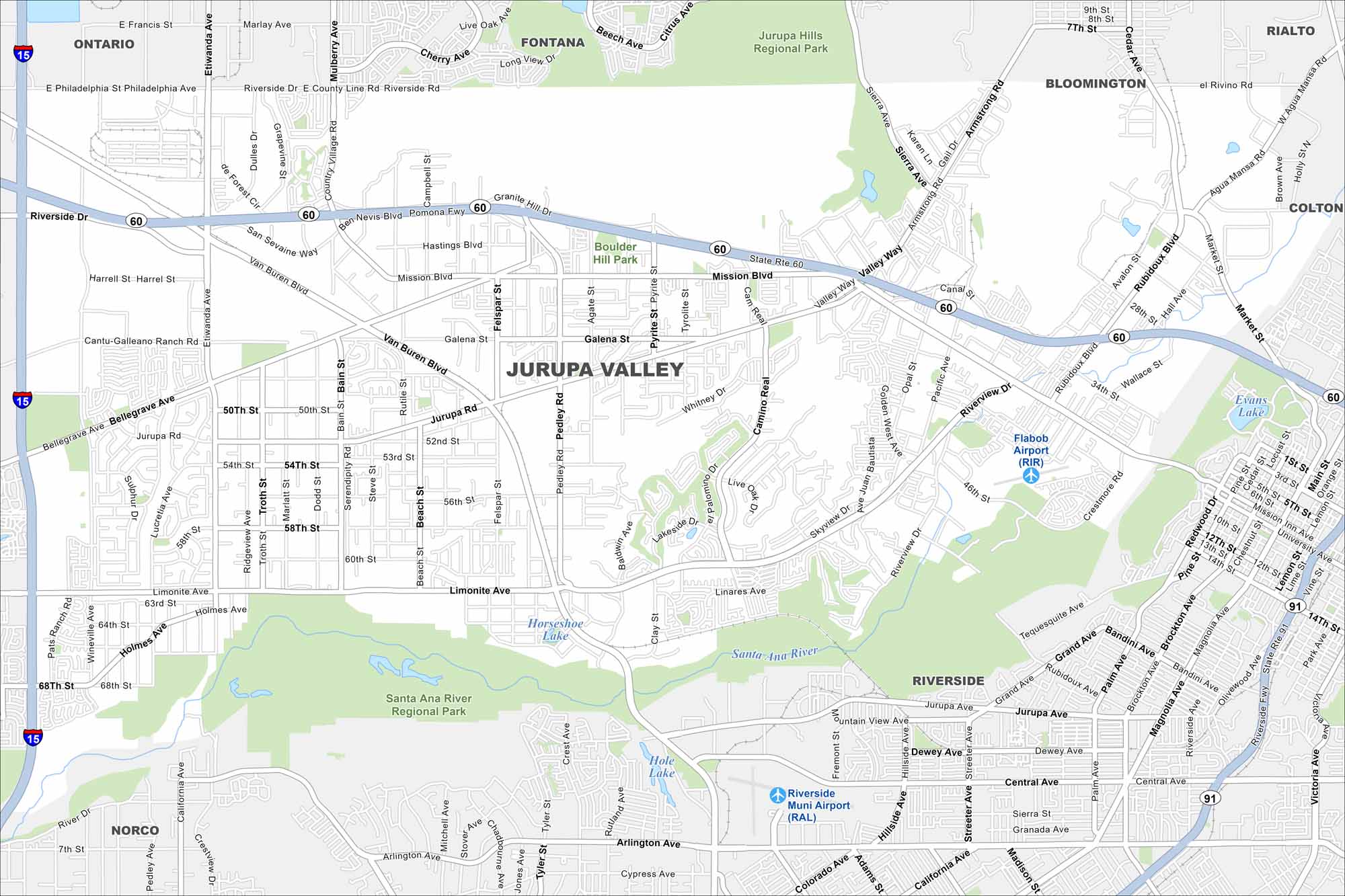
Jurupa Valley lies in the Inland Empire. Our map highlights neighborhoods spread between freeways and foothills. The Santa Ana River cuts along its southern edge.
California State Maps
Explore California with our state maps


Map Information
On the Map
Interstates/Highways: I-15, State Rte 60, State Rte 91 Major Roads: Mission Blvd, Van Buren Blvd, Limonite Ave, Jurupa Rd, Bellegrave Ave, Riverside Dr, Valley Way, Market St, Sierra Ave, Main St, Etiwanda Ave, Pyrite St, Pedley Rd, Arlington Ave, Central Ave Airports: Flabob Airport (RIR), Riverside Muni Airport (RAL) Lakes and Reservoirs: Evans Lake, Hole Lake, Horseshoe Lake Major Rivers: Santa Ana River Parks and Preserves: Jurupa Hills Regional Park, Santa Ana River Regional Park, Boulder Hill Park Nearby Communities: Ontario, Fontana, Bloomington, Rialto, Colton, Riverside, NorcoCalifornia City Maps
Here are detailed maps of California


