Map of Jersey City, New Jersey
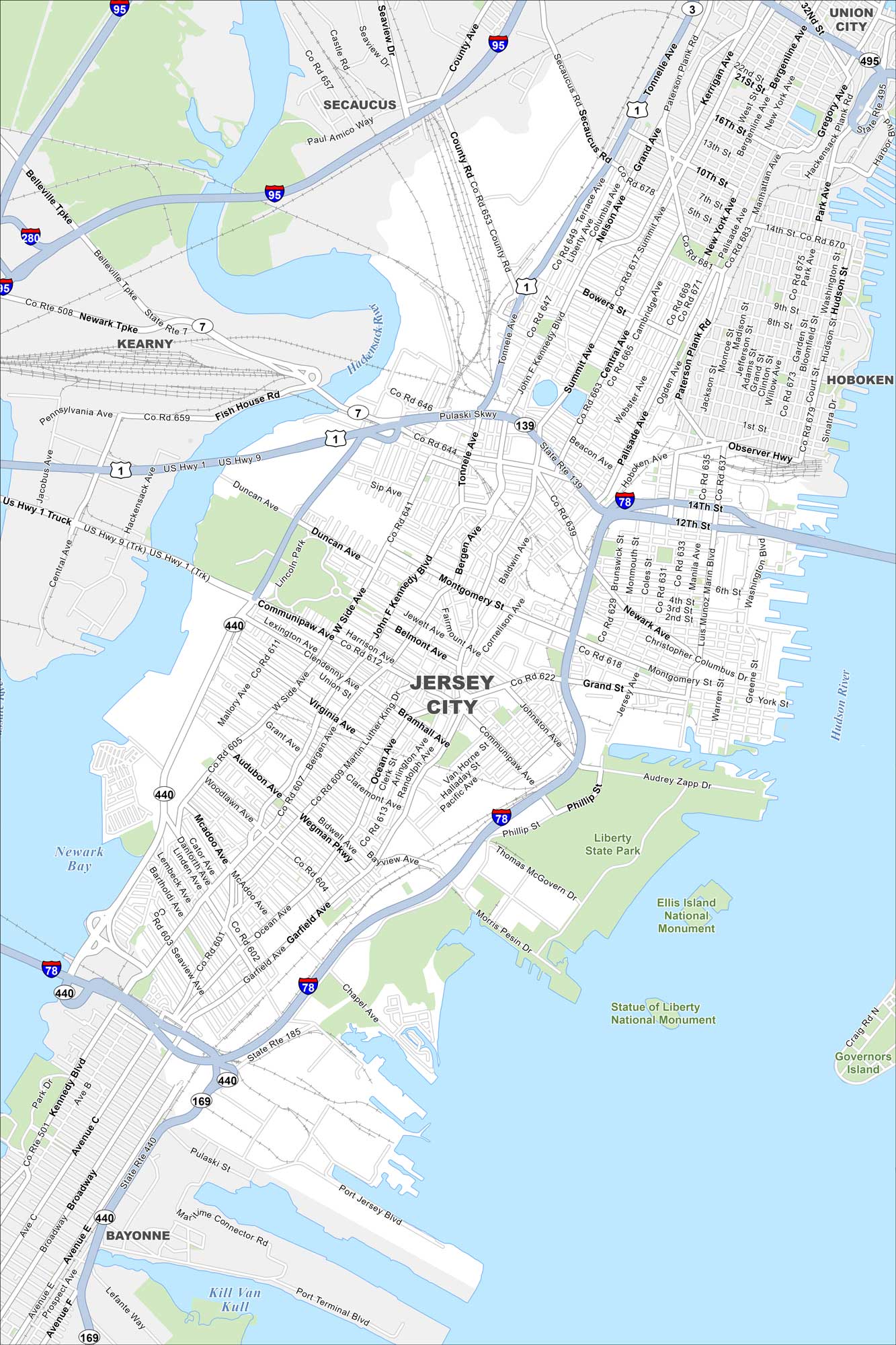
Jersey City stretches along the Hudson River across from Manhattan. Our map shows the dense waterfront skyline. Trains and ferries link it directly to New York City.
Map Information
On the Map
Interstates/Highways: I-95, I-78, I-280, I-495, US Hwy 1, US Hwy 9, US Rte 1/9, State Rte 7, State Rte 139, State Rte 440, State Rte 185, State Rte 169 Major Roads: Kennedy Blvd, West Side Ave, Bergen Ave, Ocean Ave, Garfield Ave, Summit Ave, Central Ave, Grand St, Montgomery St, Communipaw Ave, Broadway, Newark Ave, Columbus Dr, Marin Blvd, Washington Blvd, Tonnelle Ave, Sip Ave, Danforth Ave, Linden Ave, Caven Point Rd Lakes and Reservoirs: Newark Bay, Kill Van Kull, Upper New York Bay Major Rivers: Hackensack River, Hudson River Parks and Preserves: Liberty State Park, Ellis Island National Monument, Statue of Liberty National Monument, Governors Island Nearby Communities: Secaucus, Kearny, Union City, Hoboken, BayonneNew Jersey State Maps
Explore maps from the Garden State.


City Maps of New Jersey
Newark and New Jersey cities in complete detail


