Map of Irvine, California
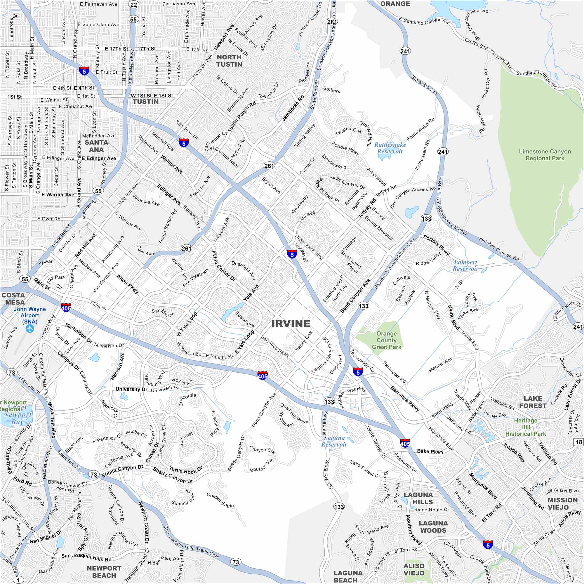
Explore our map of Irvine to see its master-planned neighborhoods. Freeways frame the city on every side. Parks, greenbelts, and university campuses stand out the most in this city.
California State Maps
Explore California with our state maps


Map Information
On the Map
Interstates/Highways: I-5, I-405, State Rte 55, State Rte 73, State Rte 133, State Rte 241, State Rte 261, State Rte 22 Major Roads: Jamboree Rd, Culver Dr, Jeffrey Rd, Sand Canyon Ave, University Dr, Alton Pkwy, Barranca Pkwy, Irvine Blvd, Main St, MacArthur Blvd, Bison Ave, Bake Pkwy, Lake Forest Dr, Moulton Pkwy, Portola Pkwy Airports: John Wayne Airport (SNA) Lakes and Reservoirs: Rattlesnake Reservoir, Lambert Reservoir, Laguna Reservoir, Newport Bay Parks and Preserves: Limestone Canyon Regional Park, Orange County Great Park, Heritage Hill Historical Park Nearby Communities: Tustin, Santa Ana, North Tustin, Costa Mesa, Newport Beach, Laguna Beach, Aliso Viejo, Laguna Woods, Laguna Hills, Mission Viejo, Lake Forest, OrangeCalifornia City Maps
Here are detailed maps of California


