Home » State Maps » Iowa National Parks and Forests Map

Iowa National Parks and Forests Map

Iowa National Parks and Forests Map

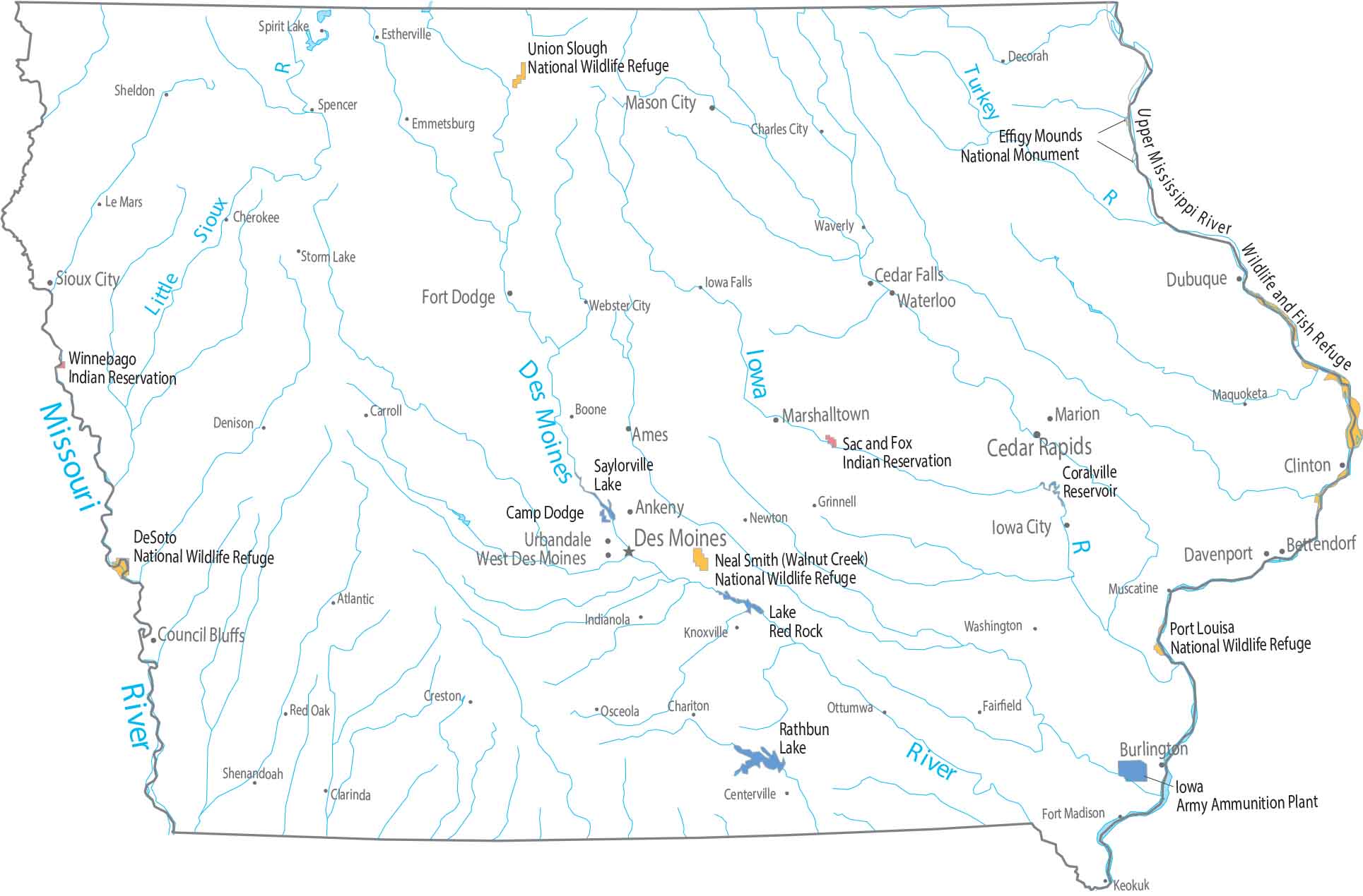
Federal land barely registers at first glance in Iowa. Our map shows only small wildlife refuges near waterways. Nothing large breaks the grid as farming defines this map.

Map Information

  • National Parks and Forests Map of Iowa
  • Original map provided by National Map. Map updated by our team.
  • Free for personal and commercial purpose. Attribution is required. How to attribute?

On the Map

Iowa Location Map
Parks, Forests and Federal Lands
National Wildlife Refuges (NWR): DeSoto NWR, Neal Smith (Walnut Creek) NWR, Port Louisa NWR, Union Slough NWR Other Federal Sites: Effigy Mounds National Monument, Upper Mississippi River Wildlife and Fish Refuge Indian Reserves (IR): Sac and Fox IR, Winnebago IR Army, Naval and Military: Camp Dodge, Iowa Army Ammunition Plant
Land Information
State Capital: Des Moines Major Cities: Cedar Rapids, Davenport, Sioux City, Waterloo Cities and Towns: Ames, Ankeny, Atlantic, Bettendorf, Boone, Carroll, Burlington, Cedar Falls, Centerville, Chariton, Charles City, Cherokee, Clarinda, Clinton, Council Bluffs, Creston, Decorah, Denison, Dubuque, Emmetsburg, Estherville, Fairfield, Fort Dodge, Fort Madison, Grinnell, Indianola, Iowa City, Iowa Falls, Keokuk, Knoxville, Le Mars, Maquoketa, Marion, Marshalltown, Mason City, Muscatine, Newton, Red Oak, Sheldon, Shenandoah, Spencer, Spirit Lake, Storm Lake, Urbandale, Washington, Waverly, Webster City, West Des Moines Lakes and Reservoirs: Coralville Reservoir, Lake Red Rock, Rathbun Lake, Saylorville Lake Major Rivers: Des Moines River, Iowa River, Little Sioux River, Missouri River, Turkey River

References

  1. National Park Service NPS Web Maps
  2. USDA Forest Service Digital Maps

Leave a Reply

Your email address will not be published. Required fields are marked *