Map of Imperial Beach, California
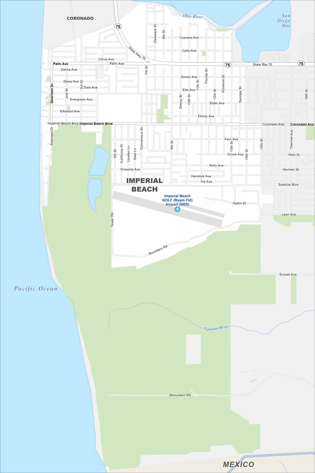
Explore our map of Imperial Beach along the Pacific shoreline. The border with Mexico sits just to the south. Wetlands and estuaries stretch inland from the coast.
California State Maps
Explore California with our state maps


Map Information
On the Map
Interstates/Highways: State Rte 75 Major Roads: Imperial Beach Blvd, Palm Ave, Coronado Ave, Seacoast Dr, 13th St, 9th St, Rainbow Dr, Saturn Blvd Airports: Imperial Beach NOLF (Ream Fld) Airport (NRS) Lakes and Reservoirs: Pacific Ocean, San Diego Bay Major Rivers: Otay River, Tijuana River Nearby Communities: Coronado, MexicoCalifornia City Maps
Here are detailed maps of California


