Map of Huntington Park, California
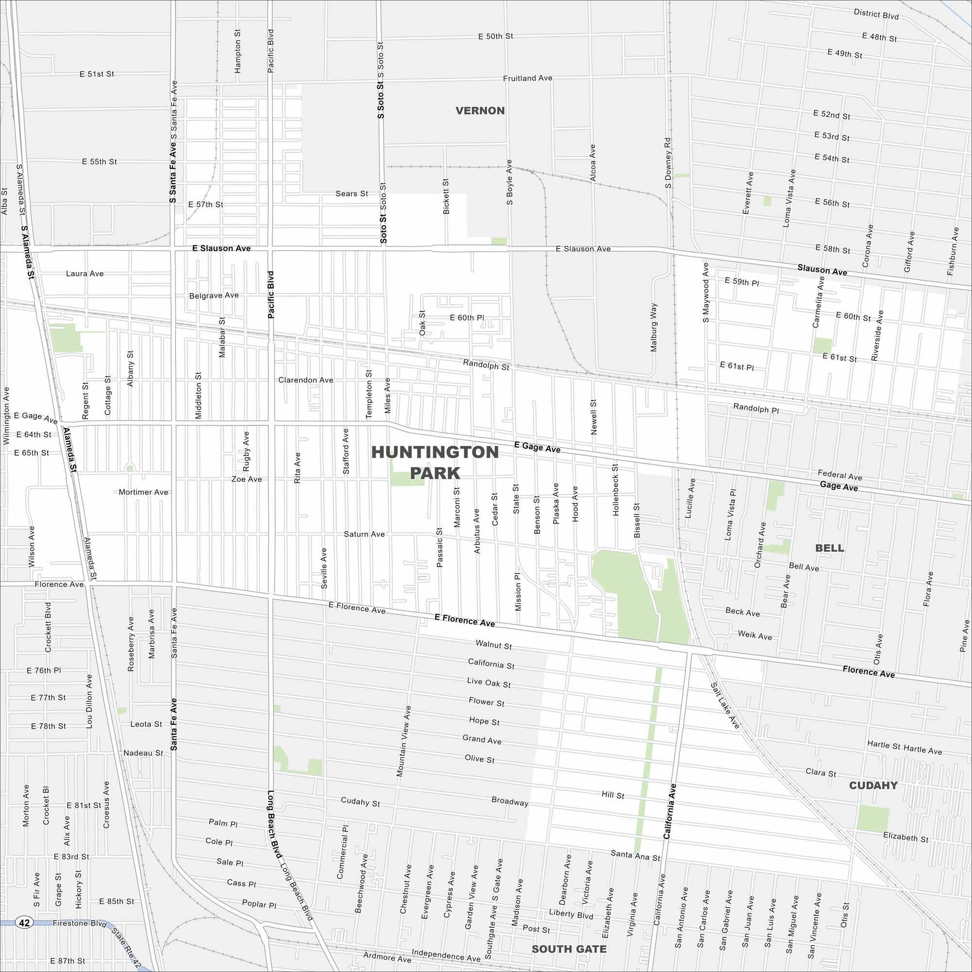
Our map of Huntington Park shows its dense road network southeast of Los Angeles. Busy corridors run through the center. The city is surrounded by tightly packed neighborhoods.
California State Maps
Explore California with our state maps


Map Information
On the Map
Interstates/Highways: State Rte 42 Major Roads: Florence Ave, Gage Ave, Slauson Ave, Pacific Blvd, Santa Fe Ave, Alameda St, Long Beach Blvd, California Ave, Firestone Blvd, Soto St, Downey Rd, Atlantic Ave Nearby Communities: Vernon, Bell, Cudahy, South GateCalifornia City Maps
Here are detailed maps of California


