Map of Huntington Beach, California
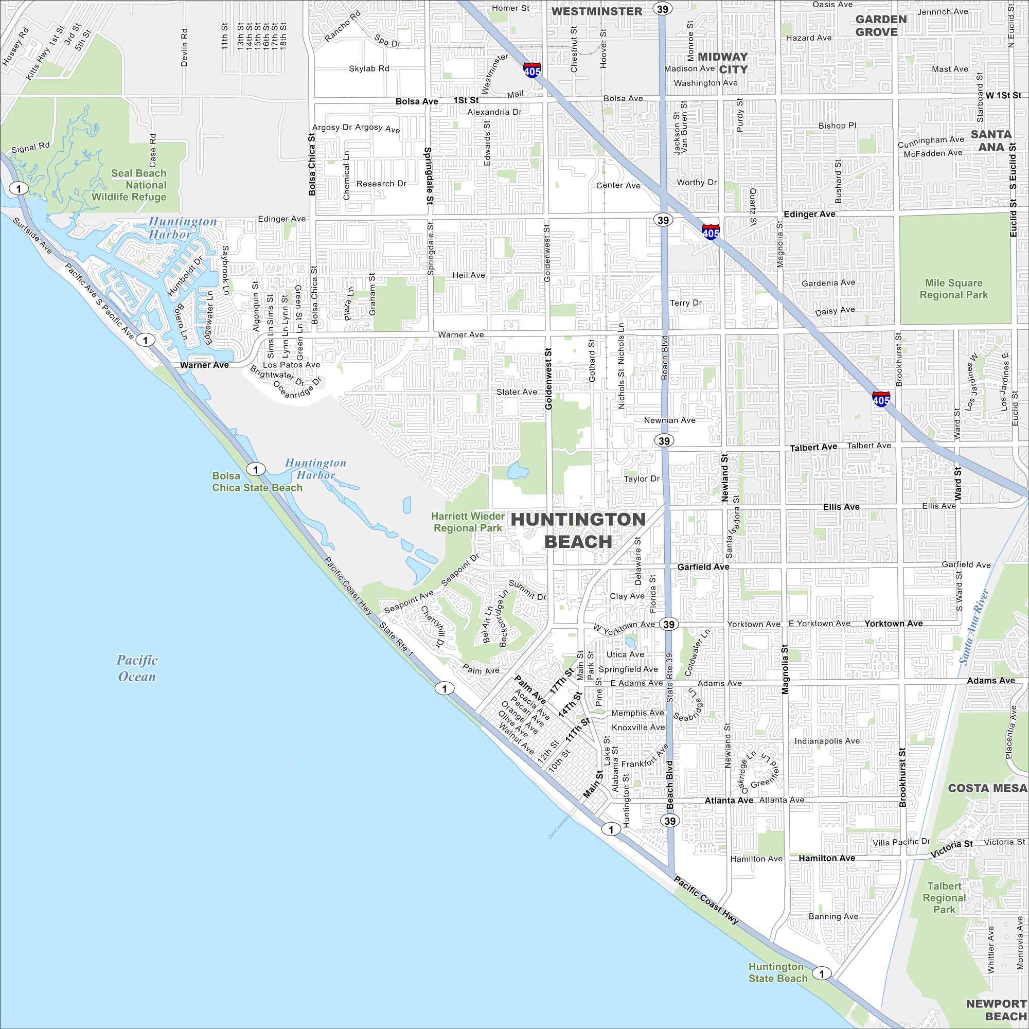
Huntington Beach is right on the Pacific Coast. The pier stands out along miles of shoreline. Inland, you’ll notice neighborhoods framed by major boulevards.
California State Maps
Explore California with our state maps


Map Information
On the Map
Interstates/Highways: I-405, State Rte 1, State Rte 39 Major Roads: Beach Blvd, Pacific Coast Hwy, Goldenwest St, Warner Ave, Bolsa Ave, Edinger Ave, Magnolia St, Brookhurst St, Slater Ave, Talbert Ave, Ellis Ave, Garfield Ave, Adams Ave, Atlanta Ave, Hamilton Ave, Gothard St, Main St, Springdale St, Edwards St, Newland St Lakes and Reservoirs: Pacific Ocean, Huntington Harbor Parks and Preserves: Seal Beach National Wildlife Refuge, Mile Square Regional Park, Harriett Wieder Regional Park, Huntington State Beach, Bolsa Chica State Beach, Huntington Central Park Nearby Communities: Westminster, Midway City, Garden Grove, Santa Ana, Costa Mesa, Newport BeachCalifornia City Maps
Here are detailed maps of California


