Map of Highland, California
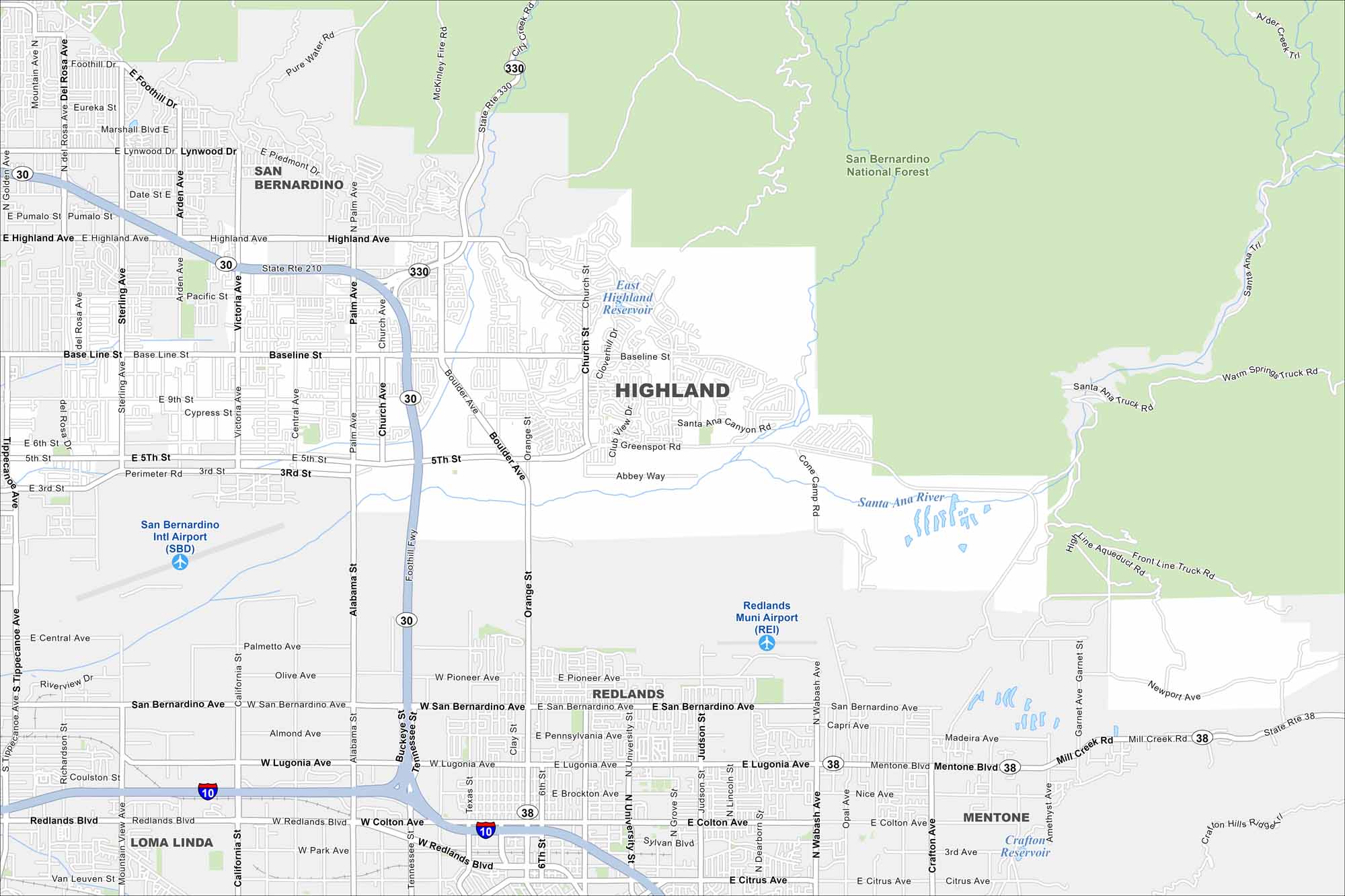
Explore our map of Highland in Southern California, which sits at the base of the San Bernardino Mountains. Freeways connect it west toward Los Angeles. San Bernardino International Airport is positioned just to the west.
California State Maps
Explore California with our state maps


Map Information
On the Map
Interstates/Highways: I-10, State Rte 30, State Rte 38, State Rte 210, State Rte 330 Major Roads: Baseline St, Highland Ave, San Bernardino Ave, Lugonia Ave, Redlands Blvd, Victoria Ave, Palm Ave, Alabama St, University St, Judson St, Dearborn St, Wabash Ave, Colton Ave, Citrus Ave, 5th St, 3rd St, Boulder Ave, Orange St, Greenspot Rd, Mentone Blvd Airports: San Bernardino Intl Airport (SBD), Redlands Muni Airport (REI) Lakes and Reservoirs: East Highland Reservoir, Crafton Reservoir Major Rivers: Santa Ana River Parks and Preserves: San Bernardino National Forest Nearby Communities: San Bernardino, Redlands, Loma Linda, MentoneCalifornia City Maps
Here are detailed maps of California


