Map of Hercules, California
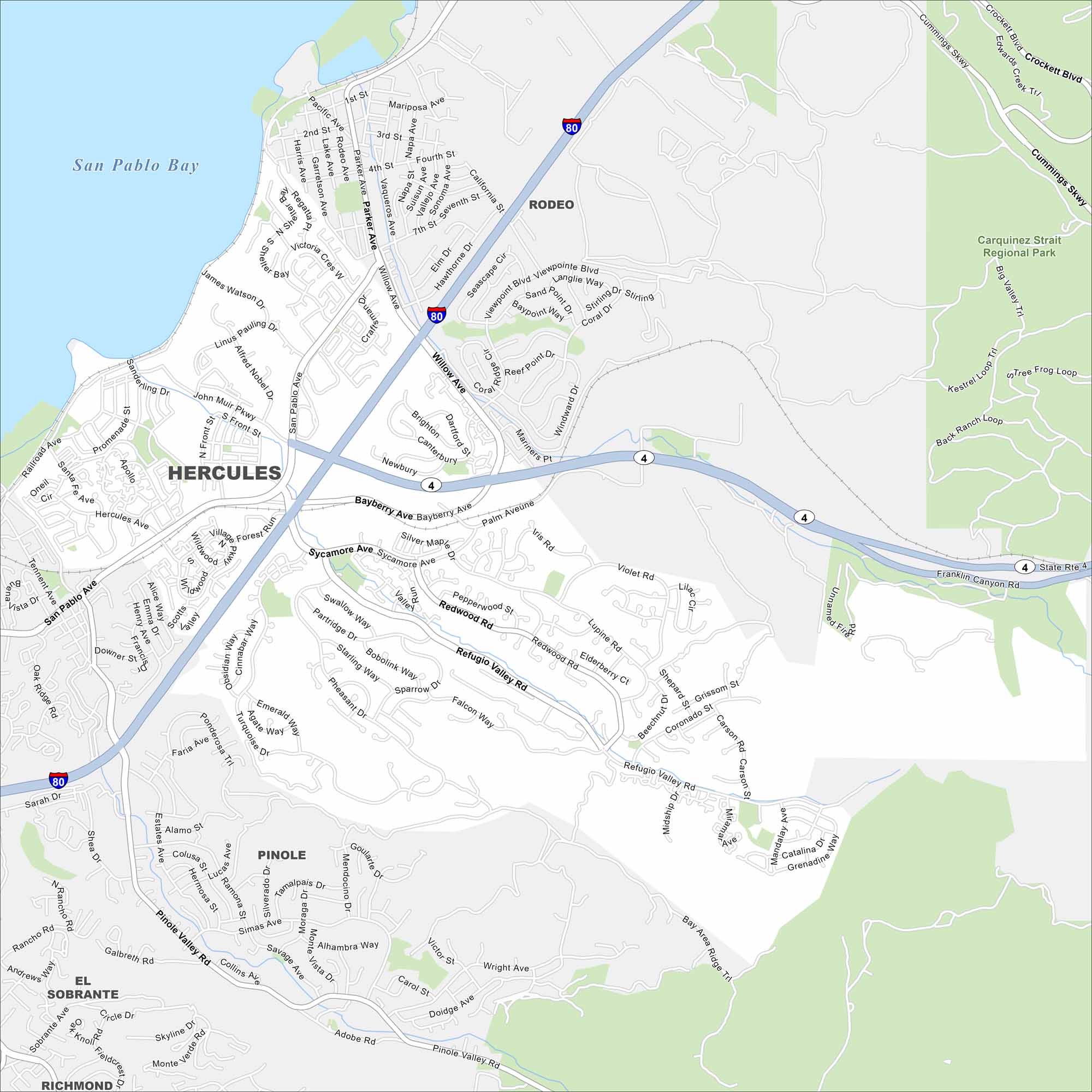
Hercules is on the northeastern edge of the San Francisco Bay Area. Our map shows this city pressed between the shoreline and nearby hills. Plus, Interstate 80 runs right through.
California State Maps
Explore California with our state maps


Map Information
On the Map
Interstates/Highways: I-80, State Rte 4 Major Roads: San Pablo Ave, Willow Ave, Refugio Valley Rd, Sycamore Ave, Pinole Valley Rd, Parker Ave, Rodeo Ave, Appian Way, Tsushima St, John Muir Pkwy, Alfred Nobel Dr, Waterfront Rd, Railroad Ave, Sarah Dr, Alhambra Way, Simas Ave, Savage Ave, Wright Ave, Doidge Ave, Pinole Ave Lakes and Reservoirs: San Pablo Bay Parks and Preserves: Carquinez Strait Regional Park Nearby Communities: Rodeo, Pinole, El Sobrante, RichmondCalifornia City Maps
Here are detailed maps of California


