Map of Hayward, California
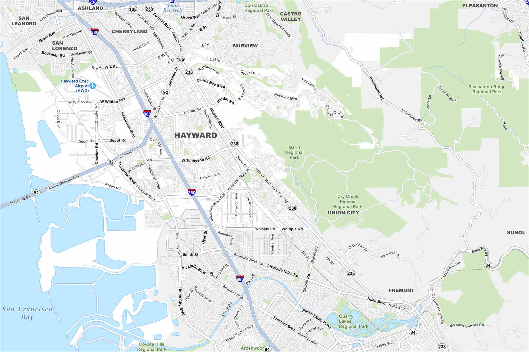
Hayward sits on the east side of the San Francisco Bay. You’ll notice wetlands along the shoreline on our map. Freeways and BART lines also bring residents directly through the city.
California State Maps
Explore California with our state maps


Map Information
On the Map
Interstates/Highways: I-880, State Rte 238, State Rte 92, State Rte 185, State Rte 84 Major Roads: Mission Blvd, Hesperian Blvd, Winton Ave, Jackson St, Tennyson Rd, Industrial Blvd, Alvarado Niles Rd, Foothill Blvd, A St, B St, D St, Carlos Bee Blvd, Harder Rd, Whitman St, Whipple Rd, Decoto Rd, Fremont Blvd, Paseo Padre Pkwy, Palomares Rd, Sunol Ridge Tr Airports: Hayward Exec Airport (HWD) Lakes and Reservoirs: San Francisco Bay, South Reservoir Parks and Preserves: Don Castro Regional Park, Castro Valley, Garin Regional Park, Dry Creek Pioneer Regional Park, Coyote Hills Regional Park, Quarry Lakes Regional Park, Pleasanton Ridge Regional Park Nearby Communities: San Leandro, Ashland, Cherryland, San Lorenzo, Fairview, Castro Valley, Union City, Fremont, Sunol, PleasantonCalifornia City Maps
Here are detailed maps of California


