Map of Hanford, California
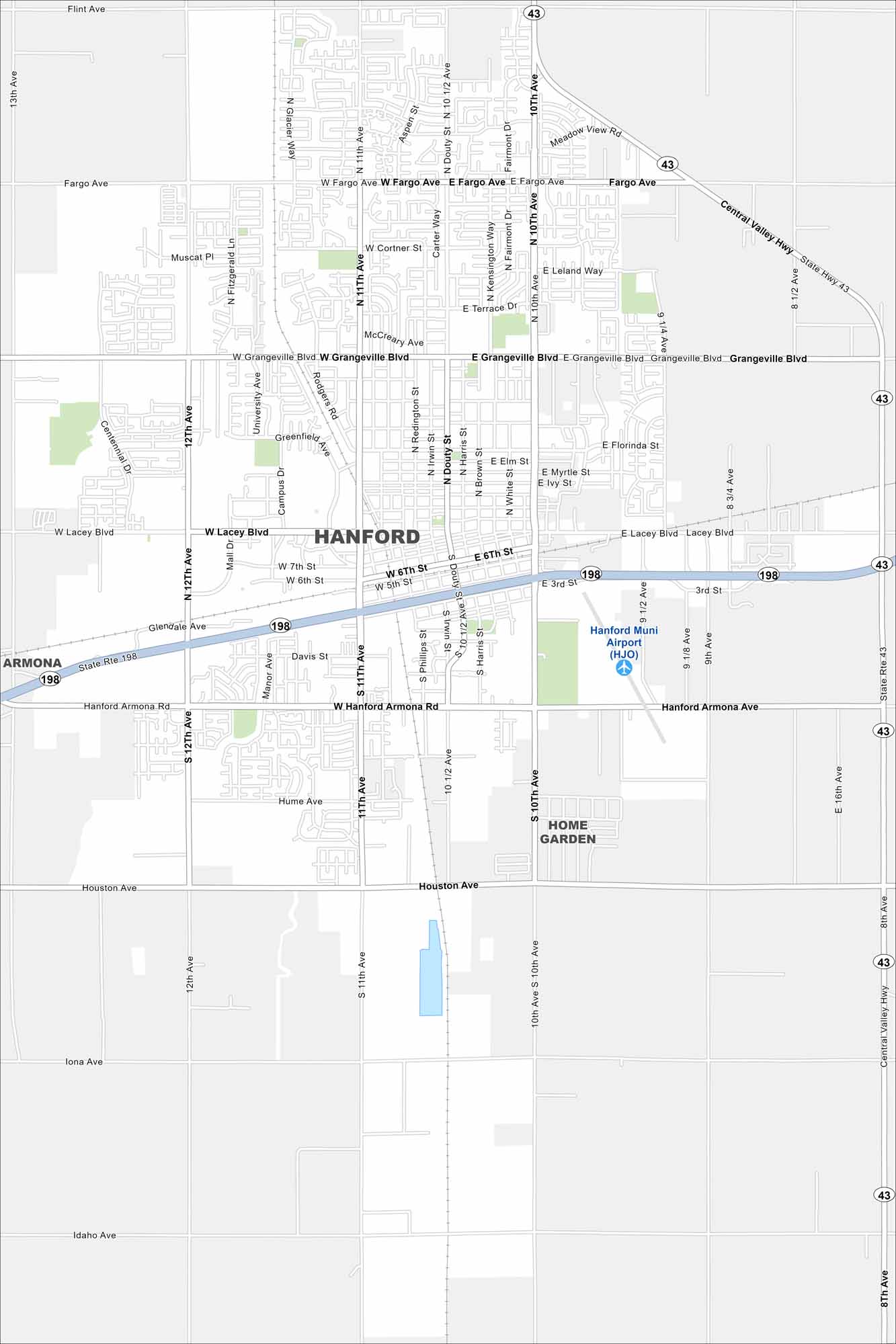
Hanford sits in California’s Central Valley between Fresno and Visalia. Our map shows the roads, railways and green spaces in the city. Farming dominates the region with its fertile soils and irrigation canals.
California State Maps
Explore California with our state maps


Map Information
On the Map
Interstates/Highways: State Rte 198, State Rte 43 Major Roads: Lacey Blvd, Hanford Armona Rd, 10th Ave, 11th Ave, 12th Ave, Fargo Ave, Grangeville Blvd, Houston Ave, Central Valley Hwy, Douty St, 10 1/2 Ave, 11th Ave, 8th Ave, 9th Ave, Iona Ave, Idaho Ave, Glendale Ave, Cortner St, Leland Way, Florinda St Airports: Hanford Muni Airport (HJO) Nearby Communities: Armona, Home GardenCalifornia City Maps
Here are detailed maps of California


