Map of Hackensack, New Jersey
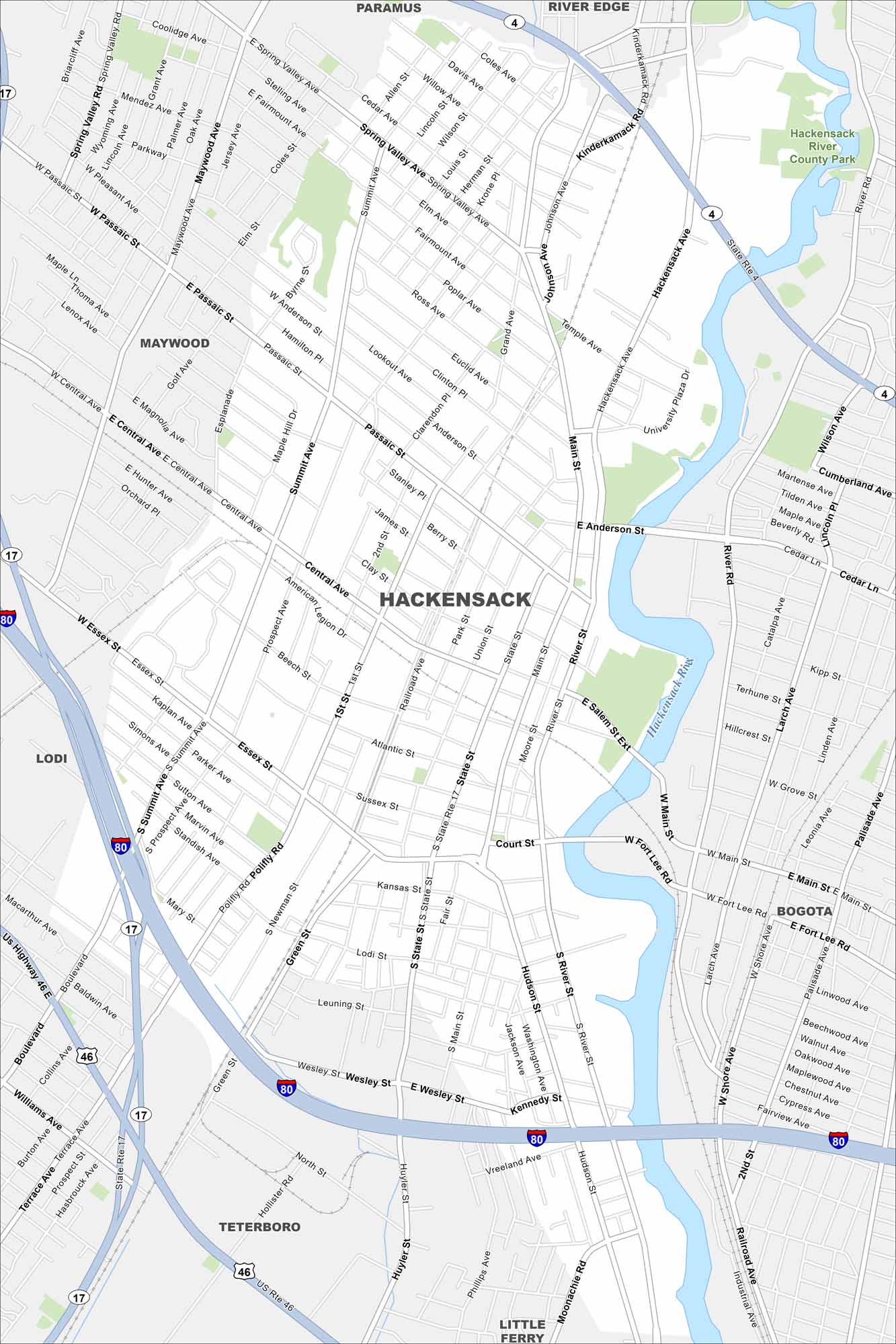
Check out our map of Hackensack in northern New Jersey. The Hackensack River runs right through the city. Its close proximity to New York City is easy to spot.
Map Information
On the Map
Interstates/Highways: I-80, State Rte 4, State Rte 17, US Highway 46 Major Roads: Main St, State St, River Rd, Passaic St, Summit Ave, Hackensack Ave, Central Ave, Essex St, Polifly Rd, Hudson St, Anderson St, Cedar Ln, Moore St, Union St, Railroad Ave, Court St, Terrace Ave, Spring Valley Rd, Kinderkamack Rd, Johnson Ave Major Rivers: Hackensack River Parks and Preserves: Hackensack River County Park Nearby Communities: Paramus, River Edge, Maywood, Lodi, Teterboro, Little Ferry, BogotaNew Jersey State Maps
Explore maps from the Garden State.


City Maps of New Jersey
Newark and New Jersey cities in complete detail


