Map of Goleta, California
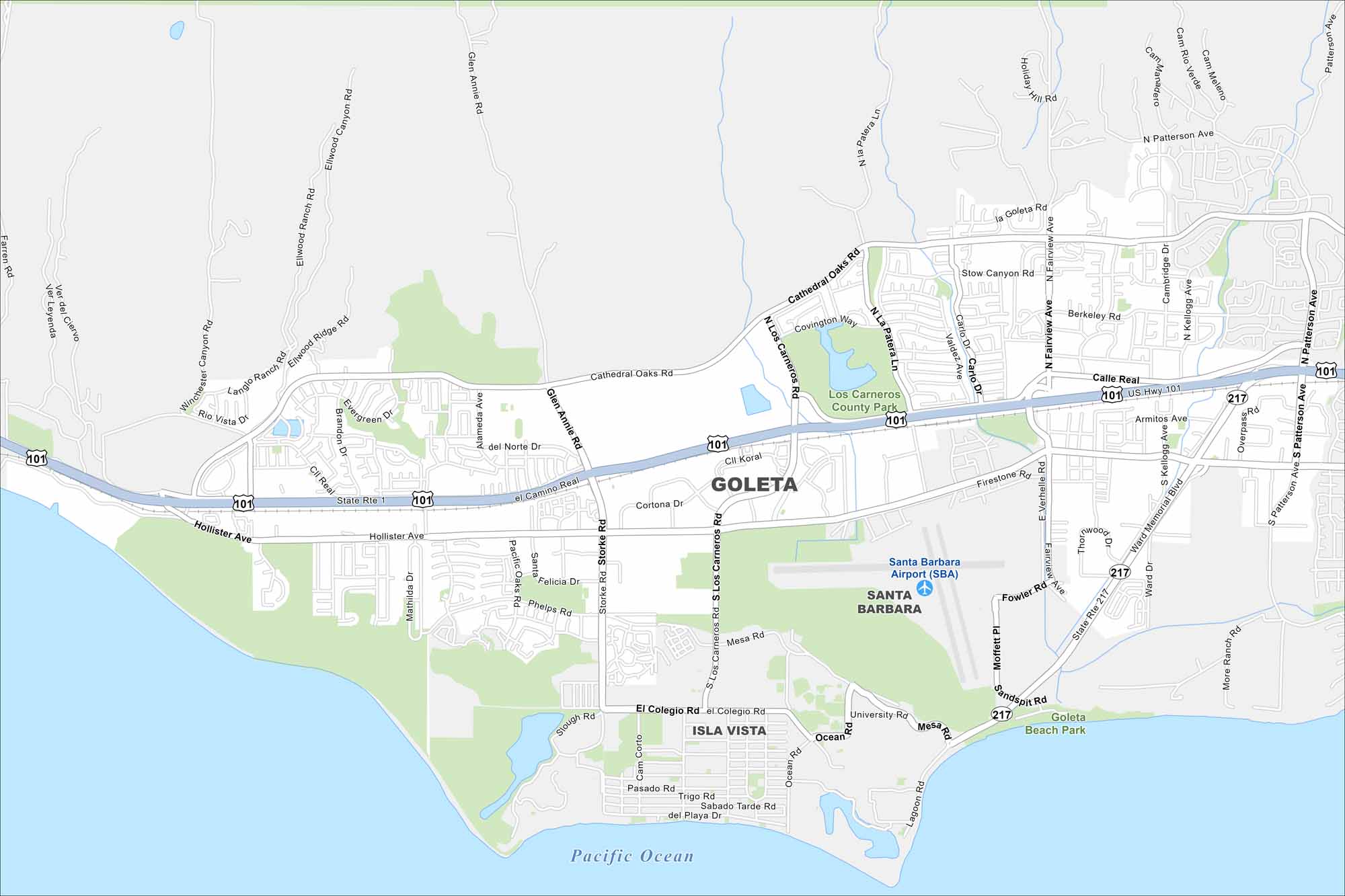
Goleta lies on the California coast just west of Santa Barbara. It’s quieter than its neighbor but still has beaches and farmland right on the map. The Pacific coastline is easy to spot.
California State Maps
Explore California with our state maps


Map Information
On the Map
Interstates/Highways: US Hwy 101, State Rte 217, State Rte 1 Major Roads: Hollister Ave, Cathedral Oaks Rd, Calle Real, Los Carneros Rd, Storke Rd, Fairview Ave, Patterson Ave, El Colegio Rd, Ward Memorial Blvd, Glen Annie Rd, Winchester Canyon Rd, Ellwood Ridge Rd, Farren Rd, Calle Koral, Cortona Dr, Mesa Rd, University Rd, Ocean Rd, Sandspit Rd, Kellogg Ave Airports: Santa Barbara Airport (SBA) Lakes and Reservoirs: Pacific Ocean Parks and Preserves: Los Carneros County Park, Goleta Beach Park Nearby Communities: Santa Barbara, Isla VistaCalifornia City Maps
Here are detailed maps of California


