Map of Glendale, California
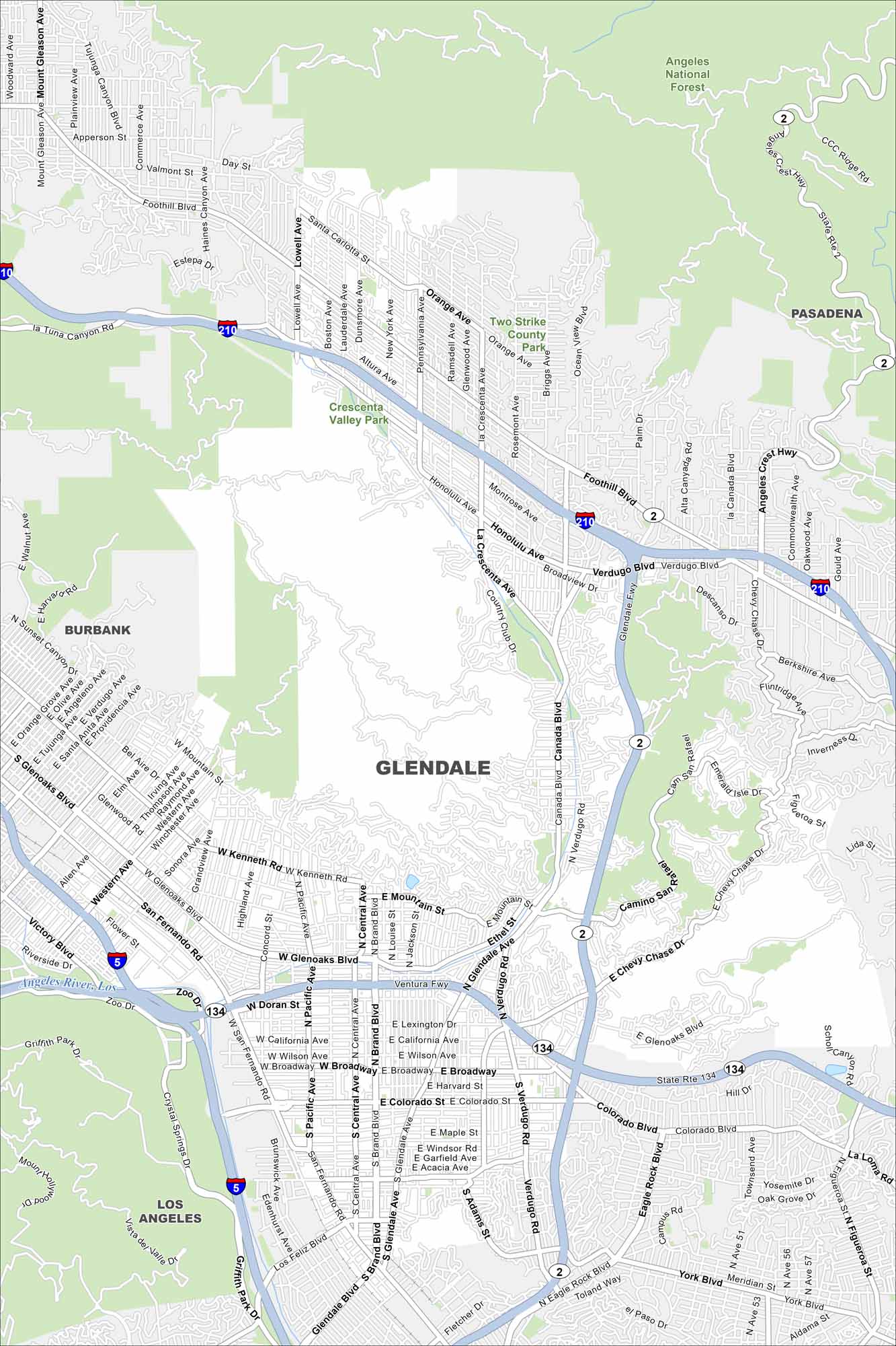
Glendale is part of the Los Angeles metro. Our map shows how neighborhoods climb into the Verdugo Mountains. It’s a busy area that sits right at the crossroads of several major freeways.
California State Maps
Explore California with our state maps


Map Information
On the Map
Interstates/Highways: I-210, I-5, State Rte 2, State Rte 134 Major Roads: Ventura Fwy, Glendale Fwy, Foothill Blvd, Verdugo Blvd, Broadway, Colorado St, Glenoaks Blvd, San Fernando Rd, Brand Blvd, Central Ave, Glendale Ave, Verdugo Rd, Canada Blvd, La Crescenta Ave, Chevy Chase Dr, Honolulu Ave, Montrose Ave, Lowell Ave, Ocean View Blvd, Pennsylvania Ave Airports: Los Angeles River Parks and Preserves: Angeles National Forest, Two Strike County Park, Crescenta Valley Park, Griffith Park, Verdugo Park Nearby Communities: Pasadena, Burbank, Los AngelesCalifornia City Maps
Here are detailed maps of California


