Map of Germantown, Tennessee
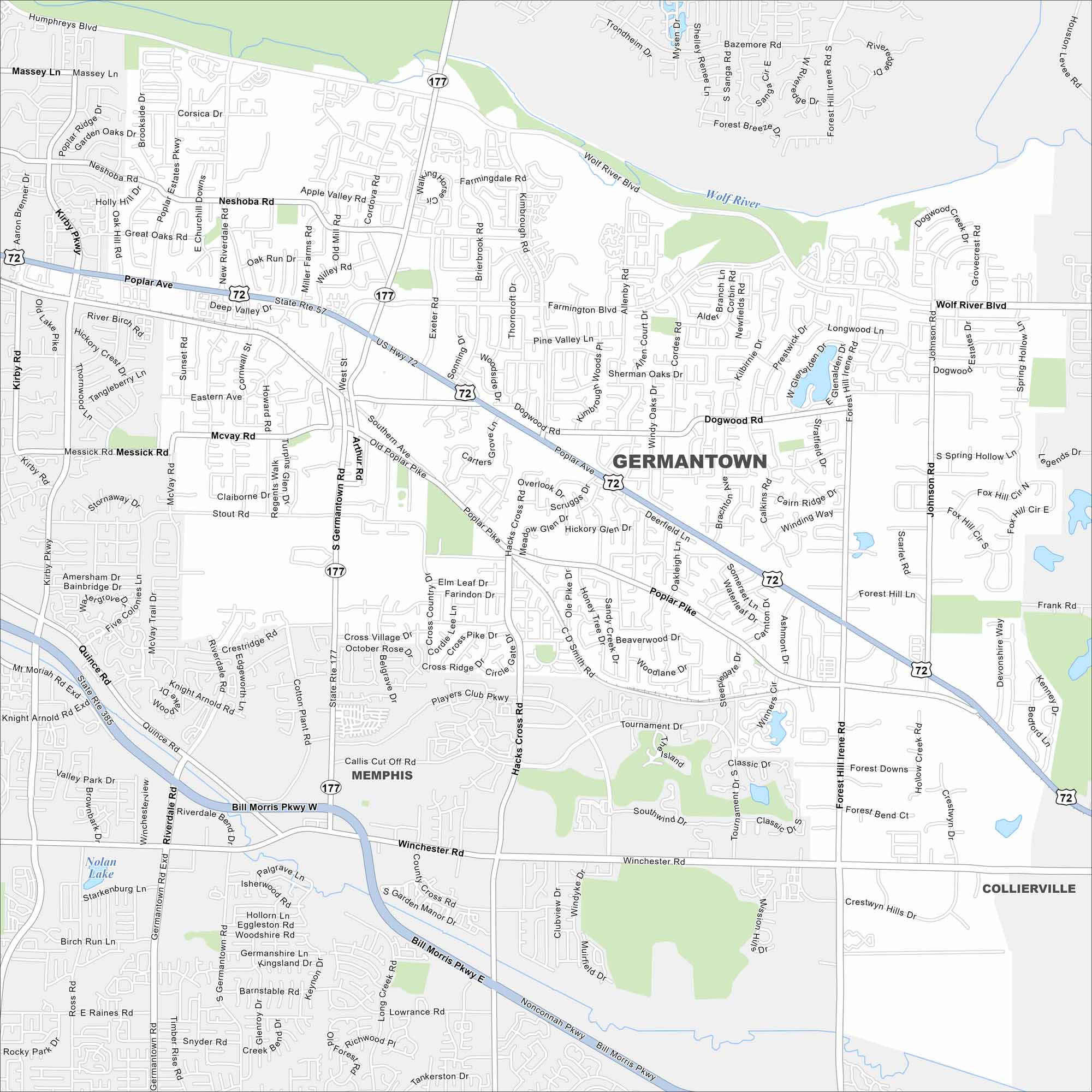
Our map of Germantown highlights the streets, parks, and highway routes. Roads are well connected here because the city is part of Greater Memphis.
Map Information
On the Map
Interstates/Highways: US Hwy 72, State Rte 57, State Rte 177, State Rte 385 Major Roads: Poplar Ave, Germantown Rd, Winchester Rd, Wolf River Blvd, Riverdale Rd, Messick Rd, Quince Rd, Stout Rd, McVay Rd, Eastern Ave, Neshoba Rd, Kirby Pkwy, Kimbrough Rd, Hacks Cross Rd, Forest Hill Irene Rd, Houston Levee Rd, Johnson Rd, Dogwood Rd, Exeter Rd, Farmington Blvd Lakes and Reservoirs: Nolan Lake Major Rivers: Wolf River Nearby Communities: Memphis, ColliervilleTennessee State Maps
Here are our state maps of Tennessee.


City Maps of Tennessee
Explore our Tennessee map collection


