Map of Gallatin, Tennessee
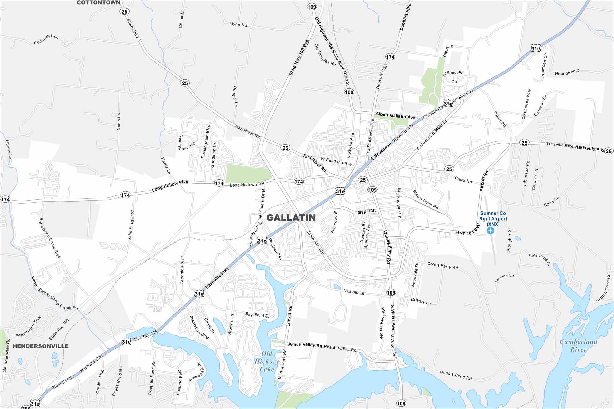
See the streets, highways, and parks laid out clearly. Our map of Gallatin highlights the roadways and waterways that run through the city. It sits on Old Hickory Lake, making it a hub for recreation.
Map Information
On the Map
Interstates/Highways: US Hwy 31E, State Rte 6, State Rte 25, State Rte 109, State Rte 174, State Rte 386 Major Roads: Nashville Pike, Main St, Broadway, Gallatin Pike, Hartsville Pike, Long Hollow Pike, Hancock St, Belvidere Dr, Airport Rd, Steam Plant Rd, Scottsville Pike, Nichols Ln, Woods Ferry Rd, South Water Ave, Lock 4 Rd, Red River Rd, Blythe Ave, Eastland Ave, Albert Gallatin Ave, Cairo Rd Airports: Sumner Co Rgnl Airport (XNX) Lakes and Reservoirs: Old Hickory Lake Major Rivers: Cumberland River Nearby Communities: Hendersonville, CottontownTennessee State Maps
Here are our state maps of Tennessee.


City Maps of Tennessee
Explore our Tennessee map collection


