Map of Fresno, California
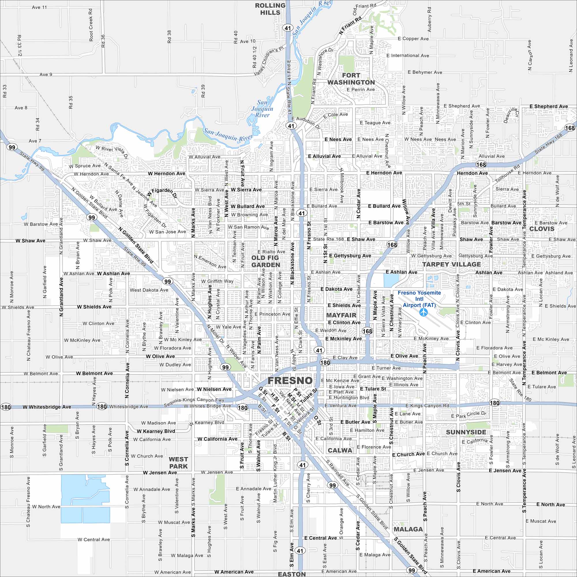
Fresno is located in California’s Central Valley. While the Sierra Nevada rises to the east, it’s otherwise surrounded by farmland. Highways 41, 99, and 180 all meet here.
California State Maps
Explore California with our state maps


Map Information
On the Map
Interstates/Highways: State Rte 99, State Rte 41, State Rte 180, State Rte 168 Major Roads: Golden State Blvd, Blackstone Ave, Shaw Ave, Herndon Ave, Blackstone Ave, Kings Canyon Rd, Shields Ave, Belmont Ave, McKinley Ave, Clinton Ave, Olive Ave, Tulare St, Ventura St, California Ave, Jensen Ave, North Ave, Central Ave, American Ave, Chestnut Ave, Willow Ave Airports: Fresno Yosemite Intl Airport (FAT) Major Rivers: San Joaquin River Nearby Communities: Clovis, Rolling Hills, Fort Washington, Tarpey Village, Old Fig Garden, Mayfair, Calwa, Sunnyside, Malaga, EastonCalifornia City Maps
Here are detailed maps of California


