Map of Freehold Borough, New Jersey
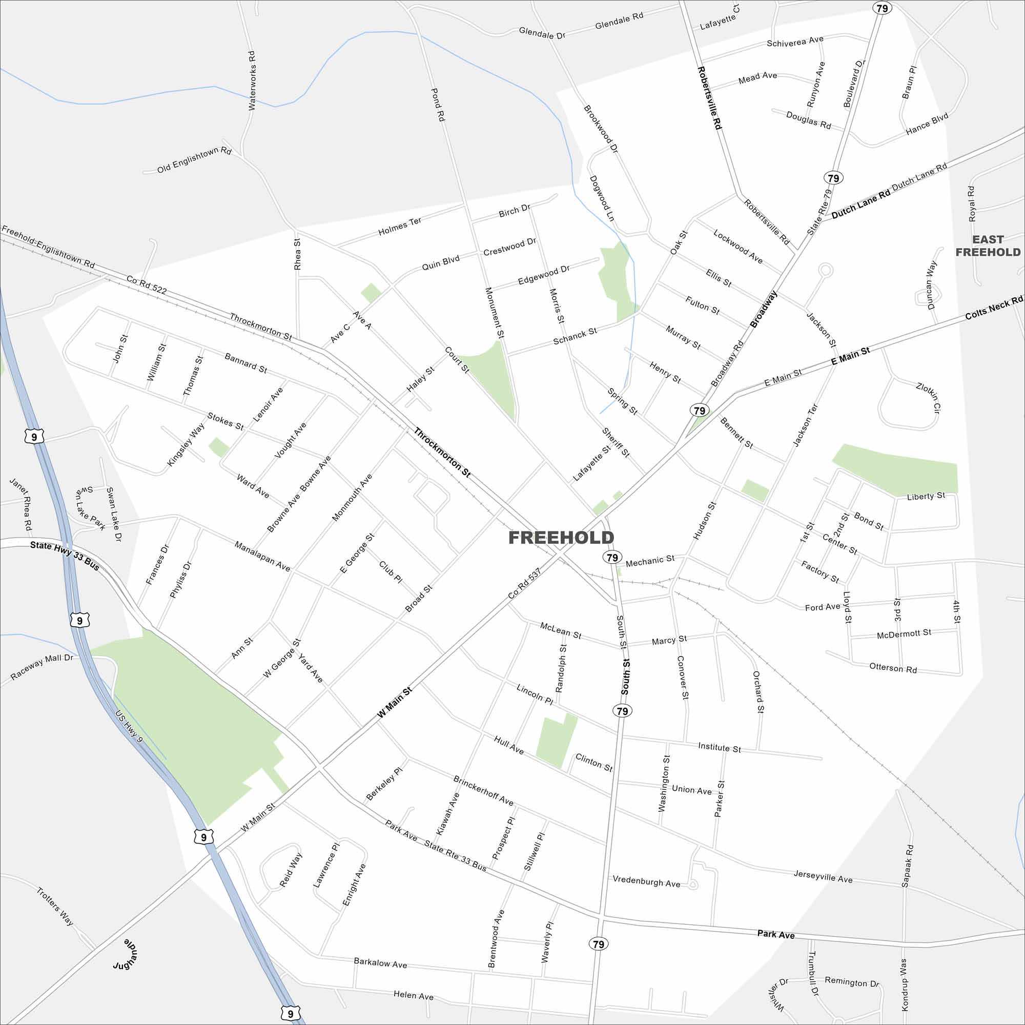
Freehold is in central New Jersey’s rolling terrain. Routes 9 and 33 cross on the west side. Our map also includes green spaces, roads and railways.
Map Information
On the Map
Interstates/Highways: US Hwy 9, State Rte 33 Bus, State Rte 79 Major Roads: Main St, Broadway, Throckmorton St, Park Ave, South St, Robertsville Rd, Monmouth Ave, Manalapan Ave, Institute St, Mechanic St, Dutch Lane Rd, Colts Neck Rd, Center St, Barkalow Ave, Vredenburgh Ave, Clinton St, McLean St, Lincoln Pl, George St, Ann St Nearby Communities: East FreeholdNew Jersey State Maps
Explore maps from the Garden State.


City Maps of New Jersey
Newark and New Jersey cities in complete detail


