Map of Folsom, California
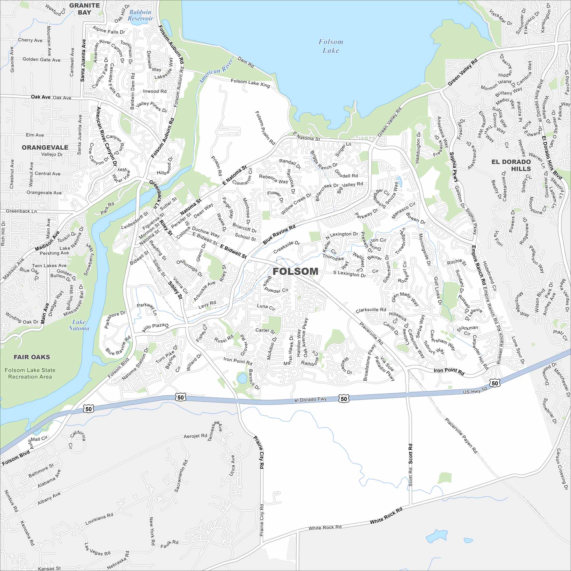
Folsom lies east of Sacramento along the American River. Folsom Lake and its dam dominate the northern edge. That big reservoir is what immediately defines our map.
California State Maps
Explore California with our state maps


Map Information
On the Map
Interstates/Highways: US Hwy 50 Major Roads: Folsom Blvd, Blue Ravine Rd, Natoma St, Bidwell St, Green Valley Rd, Iron Point Rd, E Bidwell St, Prairie City Rd, Folsom Auburn Rd, Scott Rd, White Rock Rd, Madison Ave, Greenback Ln, Sibley St, Riley St, Oak Ave, Prison Rd, Empire Ranch Rd, Placerville Rd, Oak Avenue Pkwy Lakes and Reservoirs: Folsom Lake, Lake Natoma, Baldwin Reservoir Major Rivers: American River Parks and Preserves: Folsom Lake State Recreation Area Nearby Communities: Granite Bay, Orangevale, Fair Oaks, El Dorado HillsCalifornia City Maps
Here are detailed maps of California


