Map of Fairfield, California
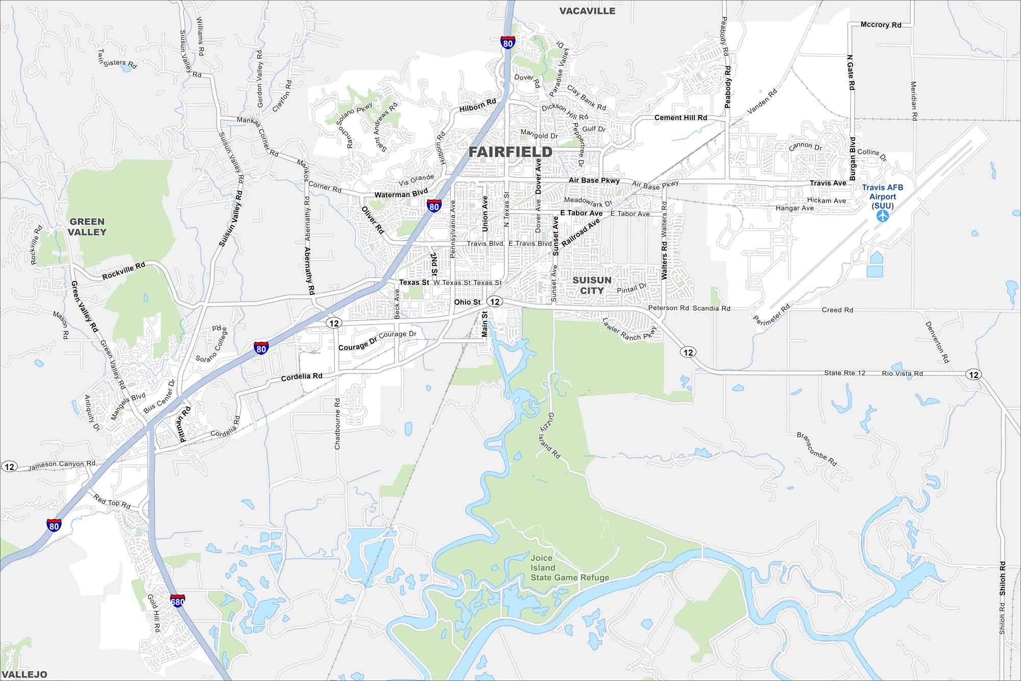
Fairfield lies between San Francisco and Sacramento in Solano County. This map shows highways, green spaces, and Travis Air Force Base. Its spot along I-80 makes it a major crossroads.
California State Maps
Explore California with our state maps


Map Information
On the Map
Interstates/Highways: I-80, I-680, State Rte 12 Major Roads: Texas St, Air Base Pkwy, Travis Blvd, Main St, Union Ave, Pennsylvania Ave, North Texas St, Suisun Valley Rd, Abernathy Rd, Rockville Rd, Cordelia Rd, Chadbourne Rd, Pittman Rd, Walters Rd, Sunset Ave, Dover Ave, Peabody Rd, Vanden Rd, Creed Rd, Rio Vista Rd Airports: Travis AFB Airport (SUU) Parks and Preserves: Joice Island State Game Refuge Nearby Communities: Vacaville, Suisun City, Green Valley, VallejoCalifornia City Maps
Here are detailed maps of California


