Map of Eureka, California
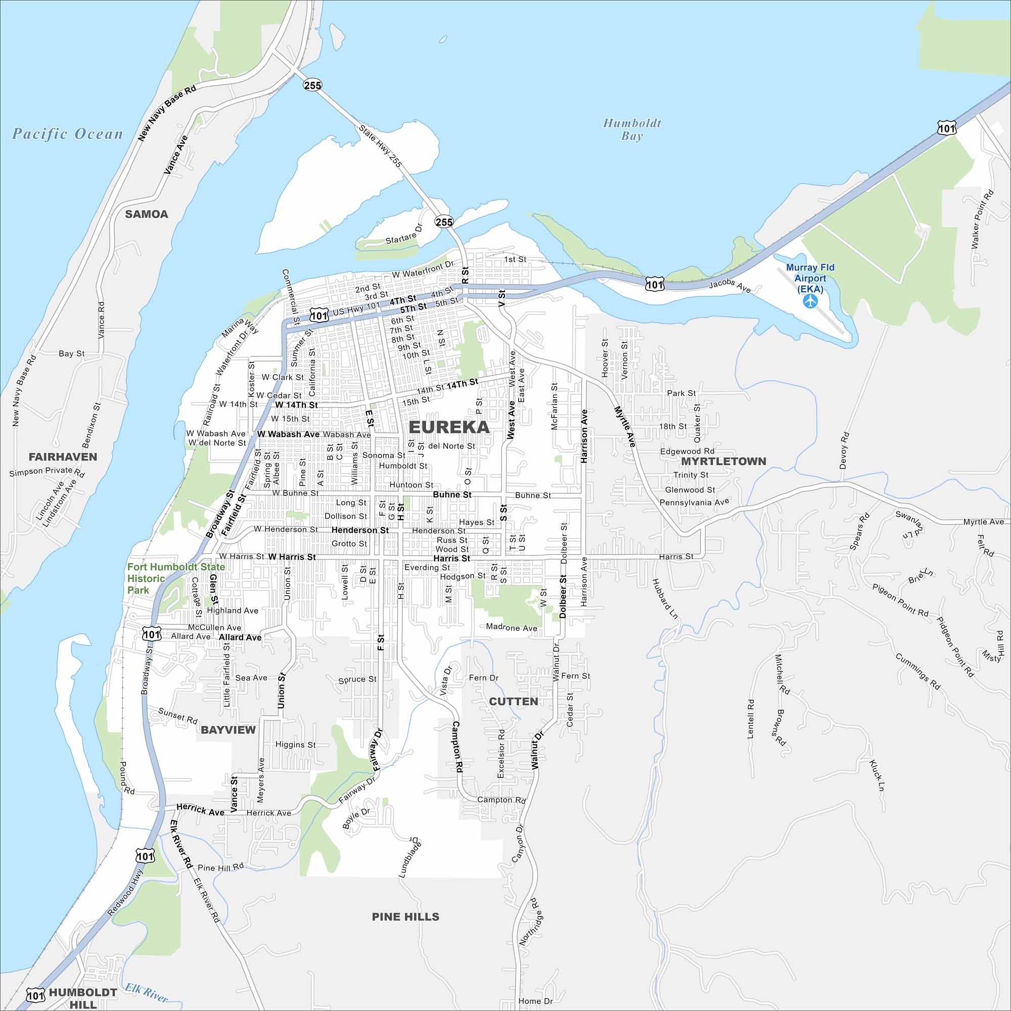
Eureka sits on Humboldt Bay along the northern California coast. It borders both redwood forests and Pacific waters with a bayfront location.
California State Maps
Explore California with our state maps


Map Information
On the Map
Interstates/Highways: US Hwy 101, State Rte 255 Major Roads: Broadway St, 4th St, 5th St, Harris St, Henderson St, Waterfront Dr, Myrtle Ave, Harrison Ave, H St, I St, Buhne St, West Ave, Dolbeer St, Walnut Dr, Campton Rd, Humboldt Hill Rd, Elk River Rd, Herrick Ave, Wabash Ave, Hodgson St Airports: Murray Fld Airport (EKA) Lakes and Reservoirs: Humboldt Bay, Pacific Ocean Major Rivers: Elk River Parks and Preserves: Fort Humboldt State Historic Park Nearby Communities: Samoa, Fairhaven, Bayview, Pine Hills, Cutten, Myrtletown, Humboldt HillCalifornia City Maps
Here are detailed maps of California


