Map of Escondido, California
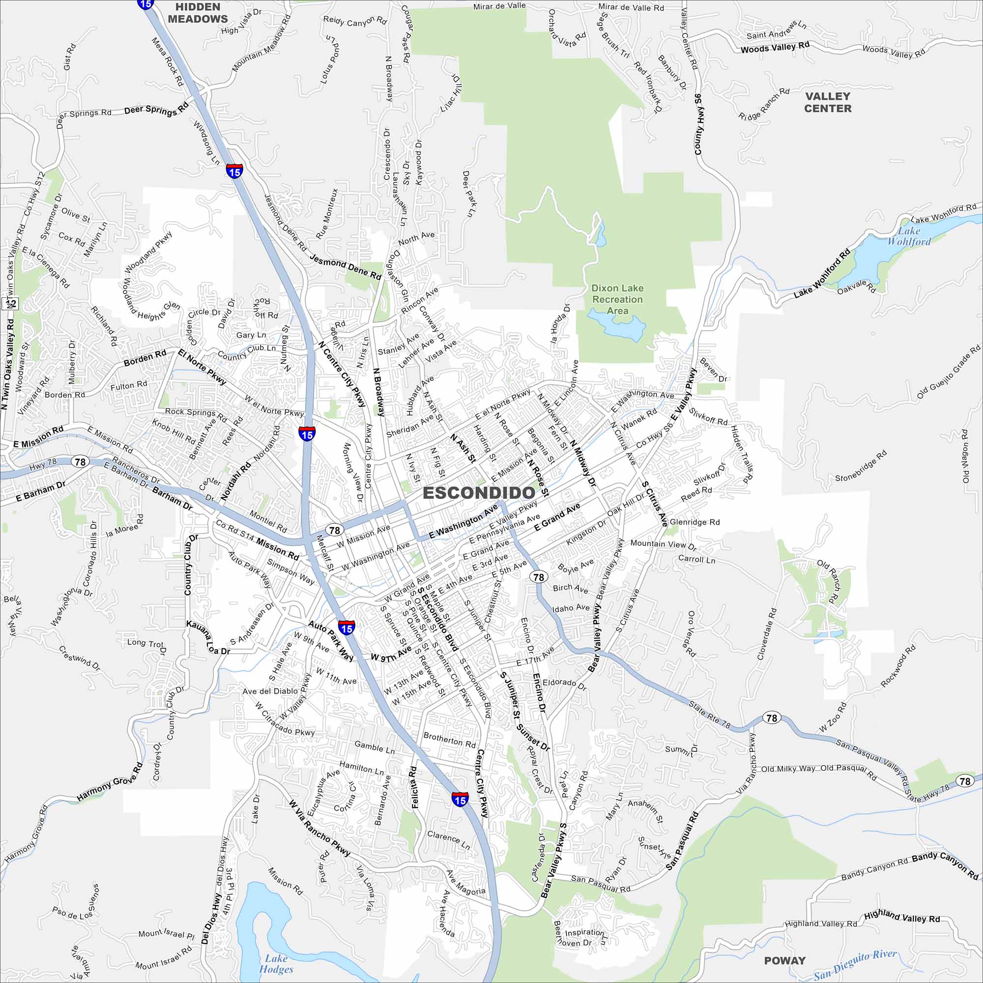
Escondido sits in a valley northeast of San Diego. This map shows its highways, roads and lakes. Lake Hodges stands out to the southwest.
California State Maps
Explore California with our state maps


Map Information
On the Map
Interstates/Highways: I-15, State Rte 78, Del Dios Hwy Major Roads: Centre City Pkwy, Escondido Blvd, Valley Pkwy, Washington Ave, Grand Ave, Mission Rd, El Norte Pkwy, Felicita Rd, Bear Valley Pkwy, Broadway, Citrus Ave, Juniper St, 9th Ave, Sunset Dr, Country Club Ln, Borden Rd, Rincon Ave, Lincoln Ave, San Pasqual Valley Rd Lakes and Reservoirs: Lake Wohlford, Lake Hodges Parks and Preserves: Dixon Lake Recreation Area Nearby Communities: Hidden Meadows, Valley Center, PowayCalifornia City Maps
Here are detailed maps of California


