Map of Eau Claire, Wisconsin
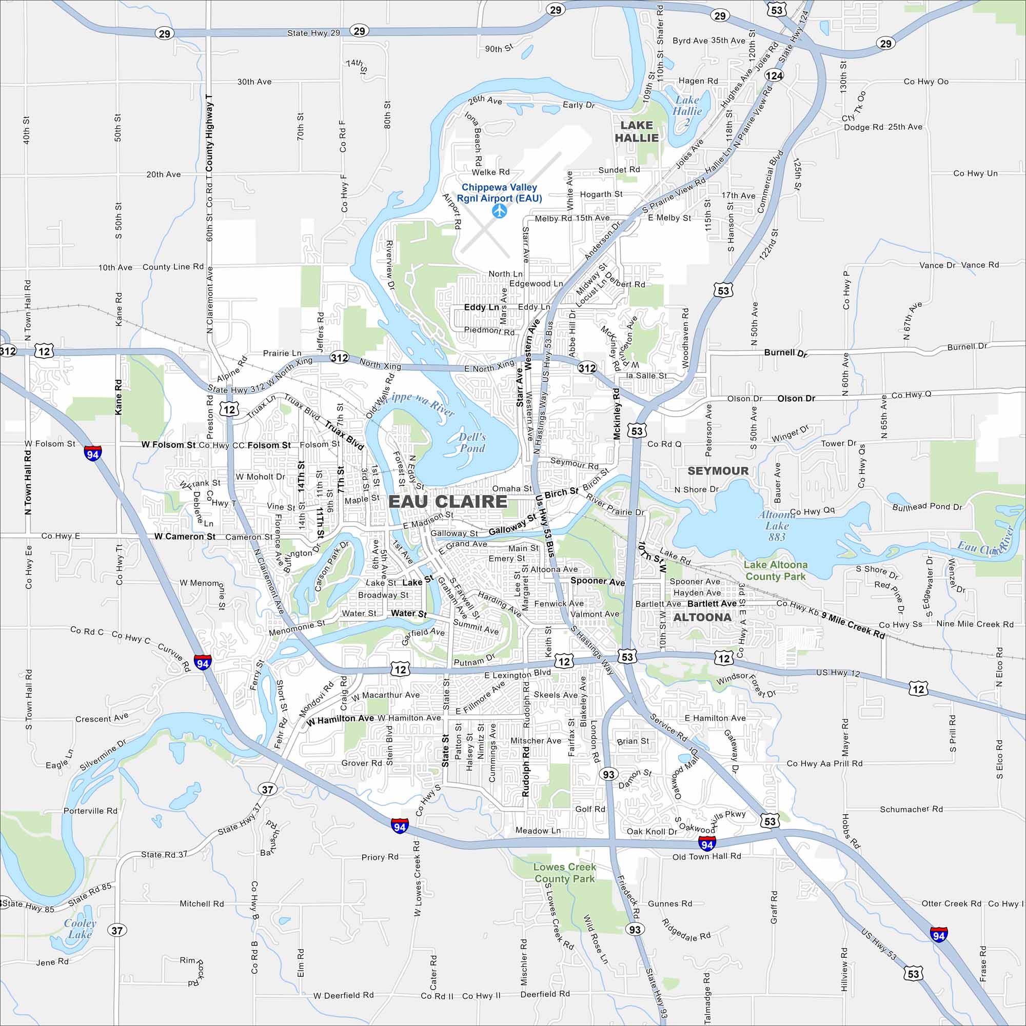
Our map of Eau Claire highlights the Chippewa and Eau Claire Rivers flowing together downtown. Trails and parks follow both waterways. The city is often nicknamed “Clear Water” because of these rivers.
Map Information
On the Map
Interstates/Highways: I-94, US Hwy 12, US Hwy 53, State Rte 29, State Rte 124, State Rte 312, State Rte 37, State Rte 85, State Rte 93 Major Roads: Clairemont Ave, Hastings Way, Madison St, Water St, Menomonie St, Birch St, River Prairie Dr, London Rd, Gateway Dr, Golf Rd, Oakwood Mall Dr, Hamilton Ave, Mitscher Ave, State St, Ferry St, Western Ave, Melby St, North Xing, Truax Blvd, Folsom St Airports: Chippewa Valley Rgnl Airport Lakes and Reservoirs: Dell’s Pond, Lake Altoona, Cooley Lake Major Rivers: Chippewa River, Eau Claire River Parks and Preserves: Lake Altoona County Park, Lowes Creek County Park Nearby Communities: Lake Hallie, Seymour, AltoonaWisconsin State Maps
Discover maps of the Badger State.


City Maps of Wisconsin
See our Wisconsin maps designed for clarity.


