Map of Desert Hot Springs, California
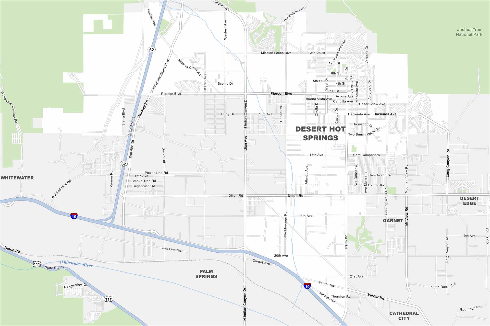
Our map of Desert Hot Springs shows this desert town north of Palm Springs. The area is famous for its natural hot mineral springs. Its layout is surrounded by open land and mountain ridges.
California State Maps
Explore California with our state maps


Map Information
On the Map
Interstates/Highways: I-10, State Rte 62, State Rte 111 Major Roads: Pierson Blvd, Dillon Rd, Indian Ave, Palm Dr, Mission Lakes Blvd, Hacienda Ave, Varner Rd, Worsley Rd, Little Morongo Rd, Mountain View Rd, Long Canyon Rd, Two Bunch Palms Trl, Ironwood Dr, Desert View Ave, Bubbling Wells Rd, Corkill Rd, 20th Ave, Scenic Dr, 13th Ave, 18th Ave Major Rivers: Whitewater River Parks and Preserves: Joshua Tree National Park Nearby Communities: Whitewater, Palm Springs, Garnet, Cathedral City, Desert EdgeCalifornia City Maps
Here are detailed maps of California


