Map of Davis, California
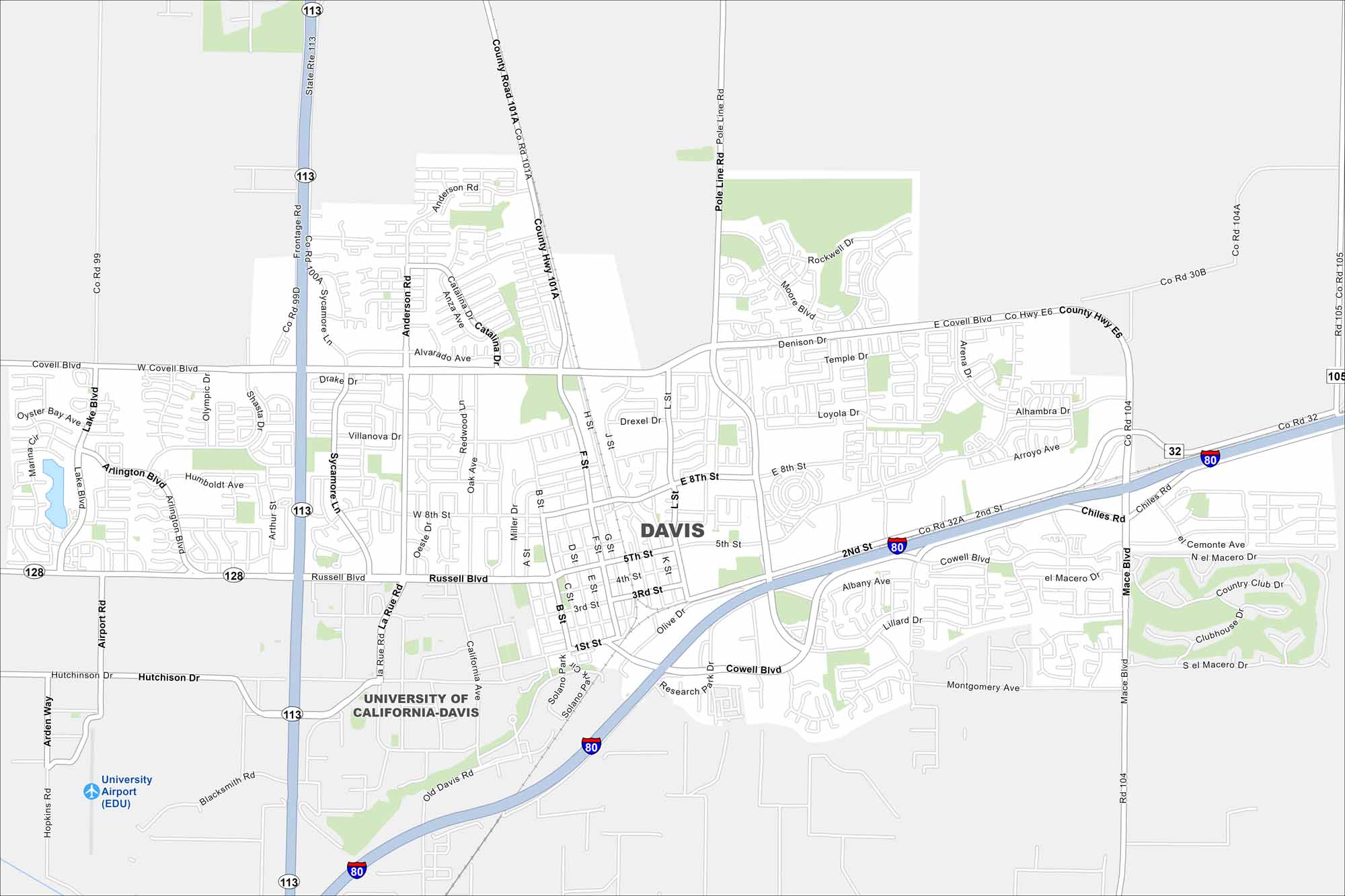
Davis appears here with its streets, highways, and nearby farmland. Located west of Sacramento, the city is known for its bike-friendly streets and UC Davis campus. See it on our map of Davis, California.
California State Maps
Explore California with our state maps


Map Information
On the Map
Interstates/Highways: I-80, State Rte 113, State Rte 128, State Rte 32 Major Roads: Russell Blvd, Covell Blvd, Mace Blvd, Richards Blvd, Pole Line Rd, Anderson Rd, Sycamore Ln, F St, L St, 5th St, 8th St, 1st St, Olive Dr, Cowell Blvd, Chiles Rd, Lillard Dr, Montgomery Ave, 2nd St, Drummond Ave, La Rue Rd Airports: University Airport (EDU) Nearby Communities: University of California-DavisCalifornia City Maps
Here are detailed maps of California


