Map of Danbury, Connecticut
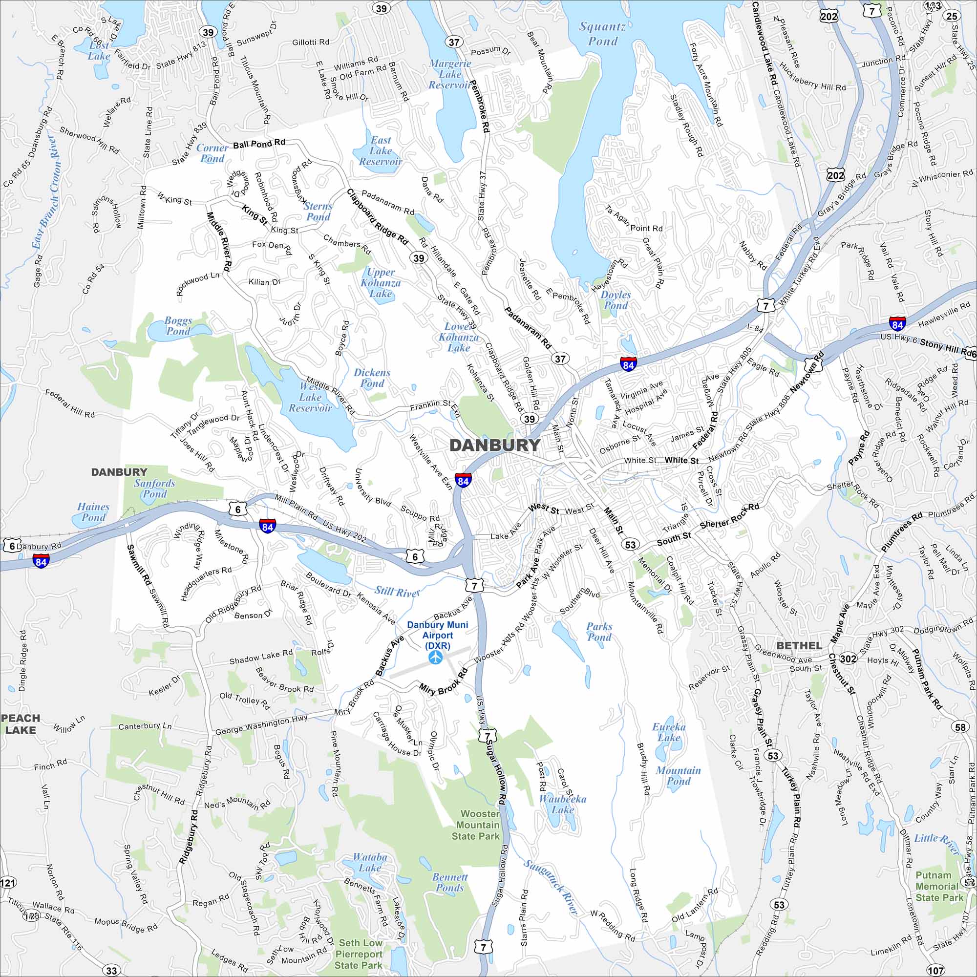
Danbury spreads along the Still River, with I-84 cutting through the heart of the city. Rolling hills are a big part of the landscape here. The historic downtown sits near the river.
Connecticut State Maps
Here’s your getaway to Connecticut geography


Map Information
On the Map
Interstates/Highways: I-84, US Hwy 7, US Hwy 202, US Hwy 6, State Rte 37, State Rte 39, State Rte 53, State Rte 58 Major Roads: Main St, West St, White St, Federal Rd, Newtown Rd, Lake Ave, Mill Plain Rd, Park Ave, Franklin St, Coalpit Hill Rd, South St, Shelter Rock Rd, Pembroke Rd, Padanaram Rd, Clapboard Ridge Rd, Kenosia Ave, Backus Ave, Miry Brook Rd, Germantown Rd, Great Plain Rd Airports: Danbury Muni Airport (DXR) Lakes and Reservoirs: Margerie Lake Reservoir, Upper Kohanza Lake, Lower Kohanza Lake, West Lake Reservoir, East Lake Reservoir, Dickens Pond, Still River, Boggs Pond, Sanfords Pond, Kenosia Lake, Waubeeka Lake, Wataba Lake, Bennett Ponds, Eureka Lake, Mountain Pond, Padanaram Reservoir Major Rivers: Little River, Saugatuck River Parks and Preserves: Wooster Mountain State Park, Putnam Memorial State Park, Seth Low Pierrepont State Park Nearby Communities: Bethel, Peach LakeConnecticut City Maps
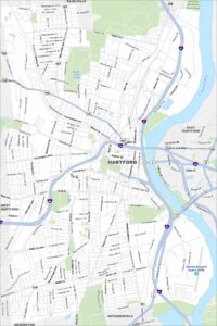
Browse Hartford and Connecticut’s city centers