Map of Culver City, California
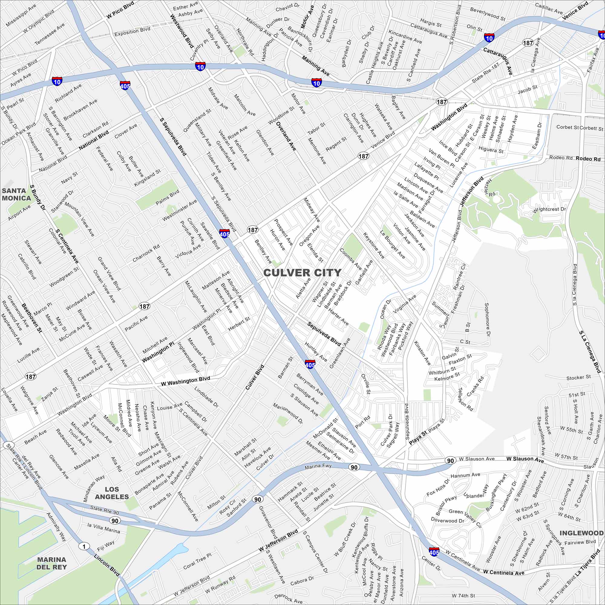
Look over Culver City with its mapped streets, highways, and parks. Known for its film studios, it lies in the heart of West Los Angeles. The Ballona Creek bike path runs across town.
California State Maps
Explore California with our state maps


Map Information
On the Map
Interstates/Highways: I-405, I-10 Major Roads: Washington Blvd, Jefferson Blvd, Sepulveda Blvd, Culver Blvd, Slauson Ave, Venice Blvd, Overland Ave, La Cienega Blvd, Centinela Ave, Pico Blvd, Marina Fwy, National Blvd, Manning Ave, Motor Ave, Washington Pl, Inglewood Blvd, Mesmer Ave, Playa St, Bristol Pkwy, Wrightcrest Dr Parks and Preserves: Baldwin Hills Scenic Overlook, Kenneth Hahn State Recreation Area Nearby Communities: Santa Monica, Los Angeles, Marina Del Rey, InglewoodCalifornia City Maps
Here are detailed maps of California


