Map of Covina, California
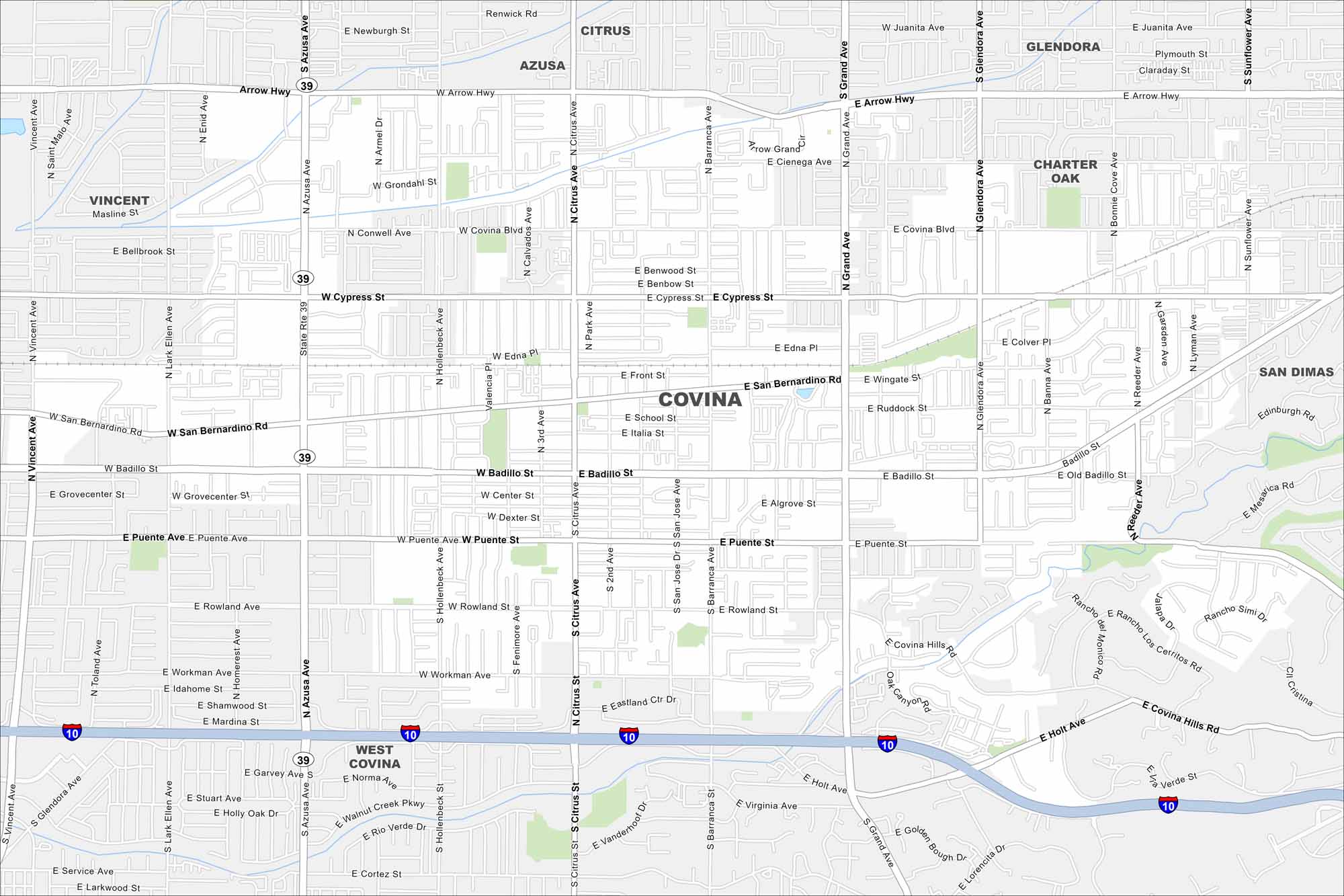
Our map of Covina shows its local roads, highways, and park areas. This city is situated east of Los Angeles and is known as “One Mile Square and All There”. The San Gabriel Mountains are part of the horizon.
California State Maps
Explore California with our state maps


Map Information
On the Map
Interstates/Highways: I-10 Major Roads: Azusa Ave, Citrus Ave, San Bernardino Rd, Badillo St, Barranca Ave, Grand Ave, Puente St, Holt Ave, Arrow Hwy, Covina Blvd, Cypress St, Rowland Ave, Workman Ave, Glendora Ave, Reeder Ave, Hollenbeck Ave, Lark Ellen Ave, Vincent Ave, San Jose Ave, Edna Pl Nearby Communities: Citrus, Azusa, Glendora, Vincent, West Covina, Charter Oak, San Dimas, Covina HillsCalifornia City Maps
Here are detailed maps of California


