Map of Corte Madera, California
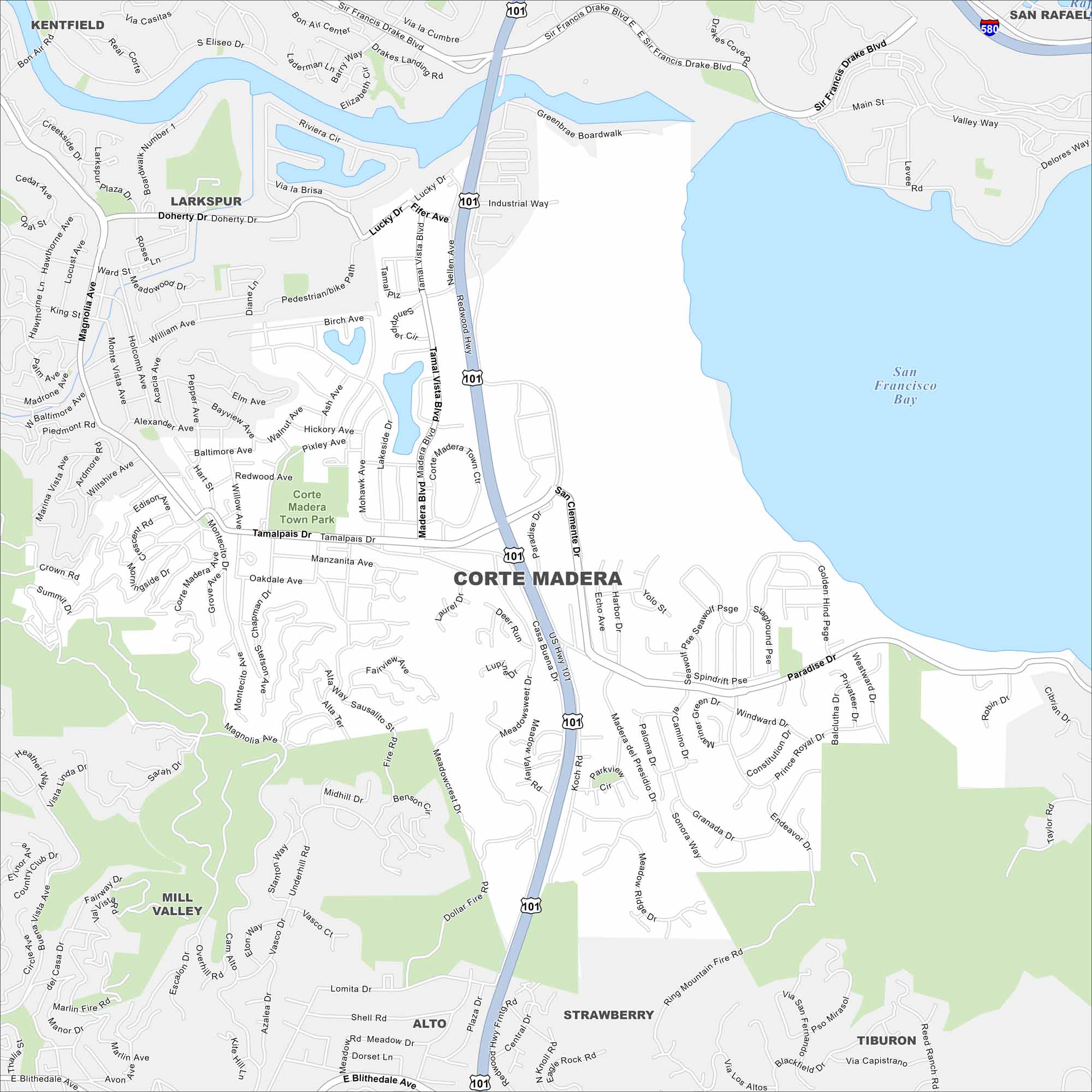
See Corte Madera with its streets, highways, and open marshlands. You can find it north of San Francisco. The bayfront lies just to the east, as shown on our map.
California State Maps
Explore California with our state maps


Map Information
On the Map
Interstates/Highways: U.S. Hwy 101, I-580 Major Roads: Redwood Hwy, Paradise Dr, Tamalpais Dr, Madera Blvd, Lucky Dr, Doherty Dr, Casa Buena Dr, San Clemente Dr, Magnolia Ave, W Blithedale Ave, E Blithedale Ave, Sir Francis Drake Blvd, Sandpiper Wy, Nellen Ave, Fifer Ave Lakes and Reservoirs: San Francisco Bay Parks and Preserves: Corte Madera Town Park Nearby Communities: Larkspur, Mill Valley, Strawberry, Tiburon, Alto, Kentfield, San RafaelCalifornia City Maps
Here are detailed maps of California


