Map of Corona, California
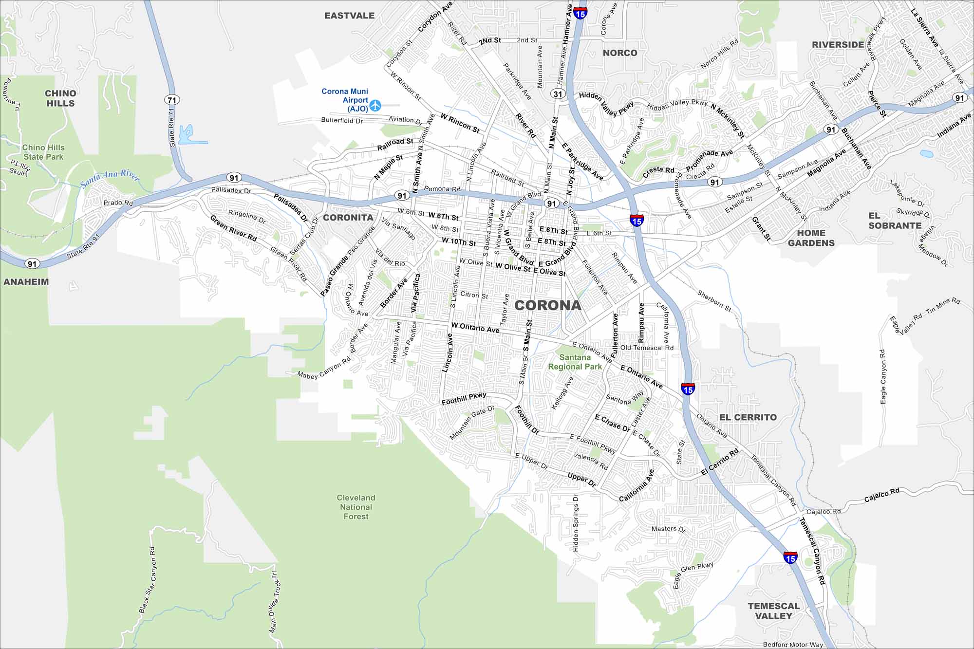
We’ve mapped Corona with its roads, highways, and foothill neighborhoods. Situated east of Los Angeles, the city sits at the base of the Santa Ana Mountains. Citrus groves once gave it the nickname “Lemon Capital of the World”.
California State Maps
Explore California with our state maps


Map Information
On the Map
Interstates/Highways: State Rte 91, I-15, State Rte 71 Major Roads: Main St, Ontario Ave, Magnolia Ave, Foothill Pkwy, McKinley St, Hidden Valley Pkwy, Rincon St, Smith Ave, Grand Blvd, Sixth St, Lincoln Ave, Joy St, Rimpau Ave, California Ave, Chase Dr, Green River Rd, Palisades Dr, Serfas Club Dr, Temescal Canyon Rd, Cajalco Rd Airports: Corona Muni Airport (AJO) Major Rivers: Santa Ana River Parks and Preserves: Cleveland National Forest, Santana Regional Park, Chino Hills State Park Nearby Communities: Norco, Eastvale, Riverside, El Cerrito, Home Gardens, Temescal Valley, Coronita, Anaheim Hills, Chino HillsCalifornia City Maps
Here are detailed maps of California


