Map of Columbia, Tennessee
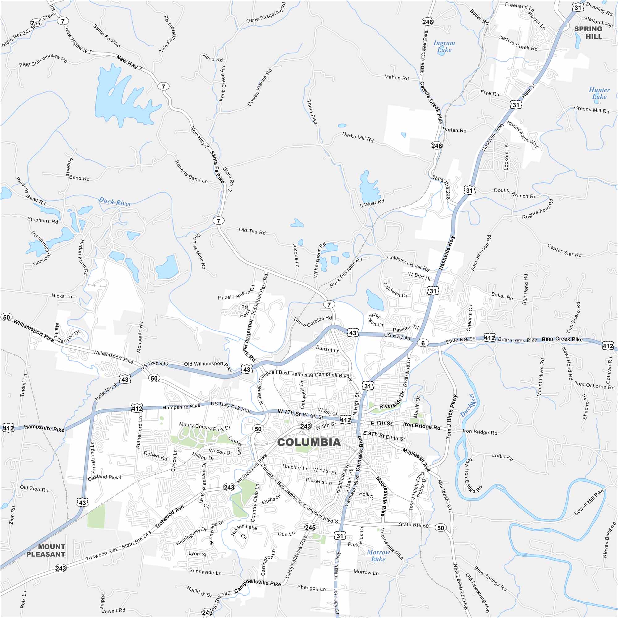
We’ve mapped Columbia with its road network and waterways. You can find it south of Nashville with the Duck River flowing through it. It’s nicknamed the “Mule Capital of the World” with its own annual mule celebration.
Map Information
On the Map
Interstates/Highways: US Hwy 31, US Hwy 412, US Hwy 43, State Rte 50, State Rte 7, State Rte 243, State Rte 245, State Rte 246, State Rte 99 Major Roads: James Campbell Blvd, Nashville Hwy, Pulaski Hwy, Trotwood Ave, Carmack Blvd, Mt Pleasant Pike, Hampshire Pike, Williamsport Pike, Bear Creek Pike, Riverside Dr, Iron Bridge Rd, Tom J Hitch Pkwy, Mooresville Pike, New Lewisburg Hwy, Theta Pike, Santa Fe Pike, Cross Bridges Rd, Sawdust Rd, Carter Creek Pike, Carters Creek Pike Lakes and Reservoirs: Ingram Lake, Hidden Lake, Morrow Lake, Hunter Lake Major Rivers: Duck River Nearby Communities: Mount Pleasant, Spring HillTennessee State Maps
Here are our state maps of Tennessee.


City Maps of Tennessee
Explore our Tennessee map collection


