Map of Coachella, California
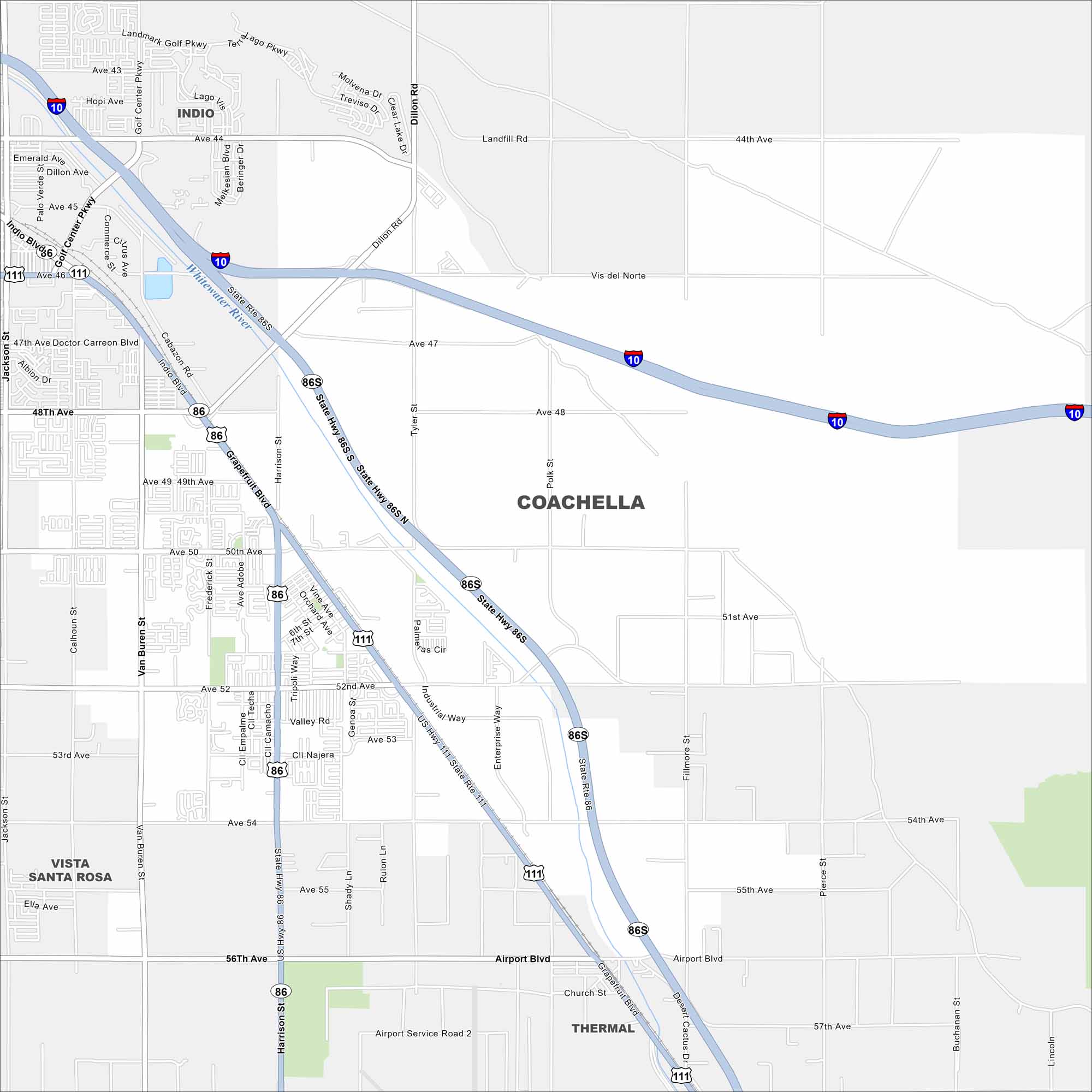
Coachella sits in the flat Coachella Valley with streets running straight across farmland. The city is famous for music festivals and is backed by the surrounding desert mountains.
California State Maps
Explore California with our state maps


Map Information
On the Map
Interstates/Highways: I-10, State Hwy 86S, State Hwy 86, State Hwy 111 Major Roads: Harrison St, Grapefruit Blvd, Airport Blvd, 48th Ave, 50th Ave, 52nd Ave, Tyler St, Polk St, Fillmore St, Pierce St, Dillon Rd, Jackson St, Van Buren St, Frederick St, Avenue 44, Avenue 46, Avenue 54, Avenue 56, Church St, Vista Del Norte Major Rivers: Whitewater River Nearby Communities: Indio, Thermal, Vista Santa RosaCalifornia City Maps
Here are detailed maps of California


