Map of Cleveland, Tennessee
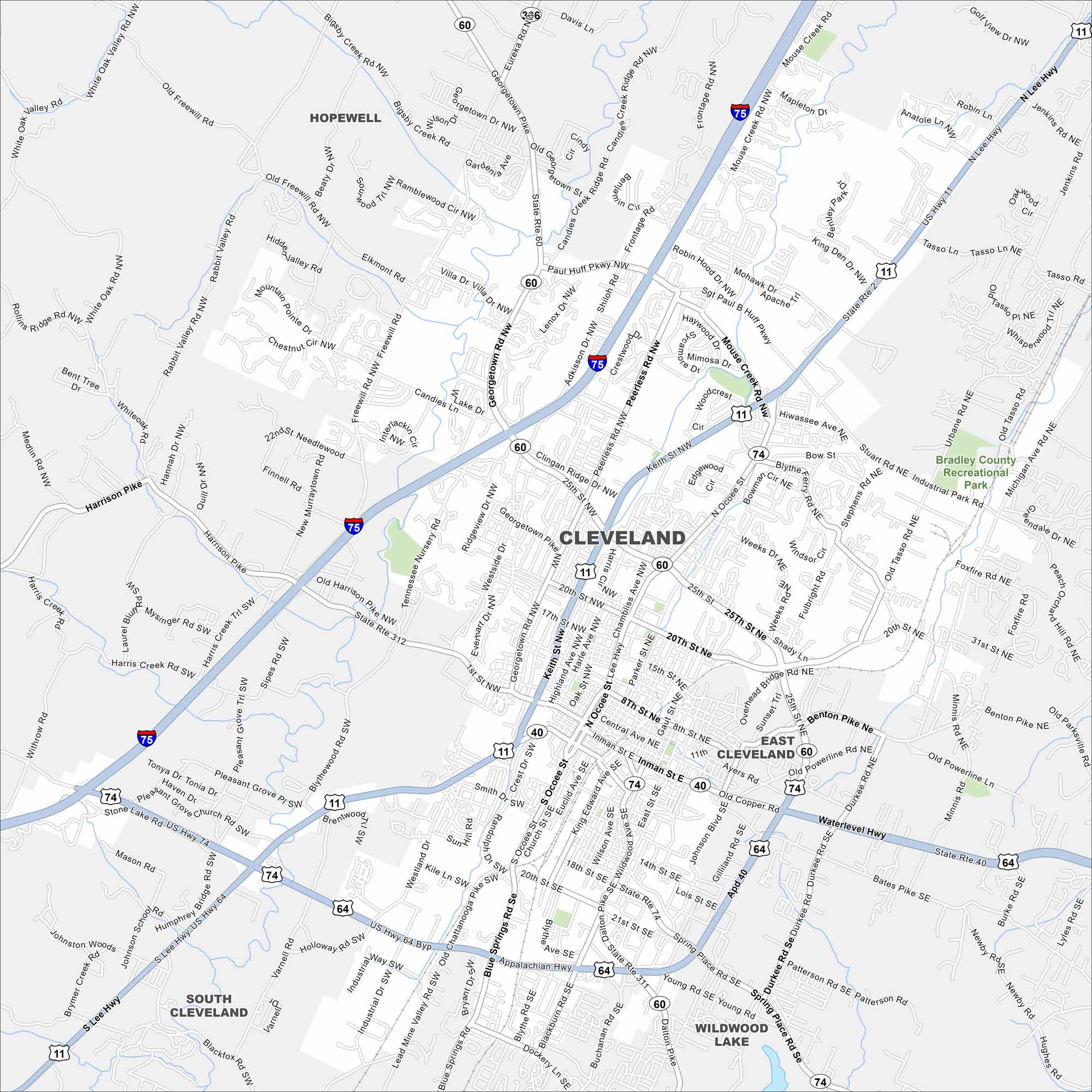
Our map of Cleveland displays its roads, streams, and green areas. Nestled in the foothills of the Appalachians, the city is surrounded by forested ridges.
Map Information
On the Map
Interstates/Highways: I-75, US Hwy 11, US Hwy 64, US Hwy 74, State Rte 60, State Rte 312, State Rte 311, State Rte 40 Major Roads: Keith St, Ocoee St, 25th St, Paul Huff Pkwy, Georgetown Rd, Harrison Pike, Blue Springs Rd, Inman St, Mouse Creek Rd, Peerless Rd, Adkisson Dr, Freewill Rd, Westside Dr, Michigan Ave, Dalton Pike, Benton Pike, Old Chattanooga Pike, APD 40, Spring Place Rd, Wildwood Ave Parks and Preserves: Bradley County Recreational Park Nearby Communities: Hopewell, South ClevelandTennessee State Maps
Here are our state maps of Tennessee.


City Maps of Tennessee
Explore our Tennessee map collection


