Map of Chula Vista, California
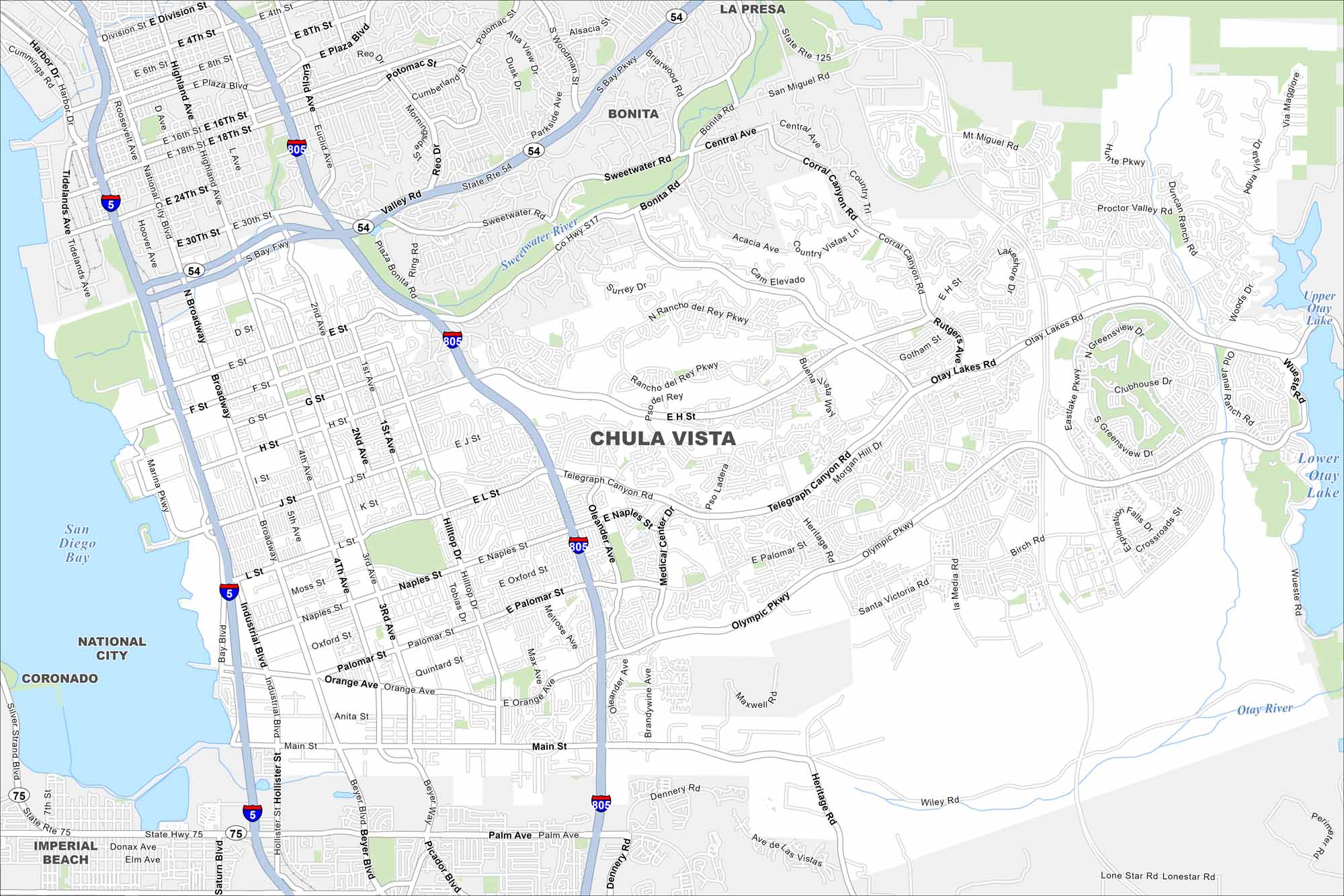
Chula Vista appears with I-805 running north–south while the bayfront spreads westward toward San Diego Bay. Inland, the city climbs steadily toward foothills that live up to its “beautiful view” name.
California State Maps
Explore California with our state maps


Map Information
On the Map
Interstates/Highways: I-5, I-805, State Hwy 75, State Hwy 125, State Rte 54 Major Roads: Broadway, Main St, Palomar St, Naples St, Orange Ave, Olympic Pkwy, Otay Lakes Rd, Telegraph Canyon Rd, Chula Vista St, Fourth Ave, Third Ave, Second Ave, First Ave, Industrial Blvd, Heritage Rd, Brandywine Ave, Melrose Ave, Oleander Ave, Hilltop Dr, Maxwell Lakes and Reservoirs: San Diego Bay, Upper Otay Lake, Lower Otay Lake Major Rivers: Sweetwater River, Otay River Nearby Communities: National City, Coronado, Imperial Beach, Bonita, La PresaCalifornia City Maps
Here are detailed maps of California


