Map of Chino, California
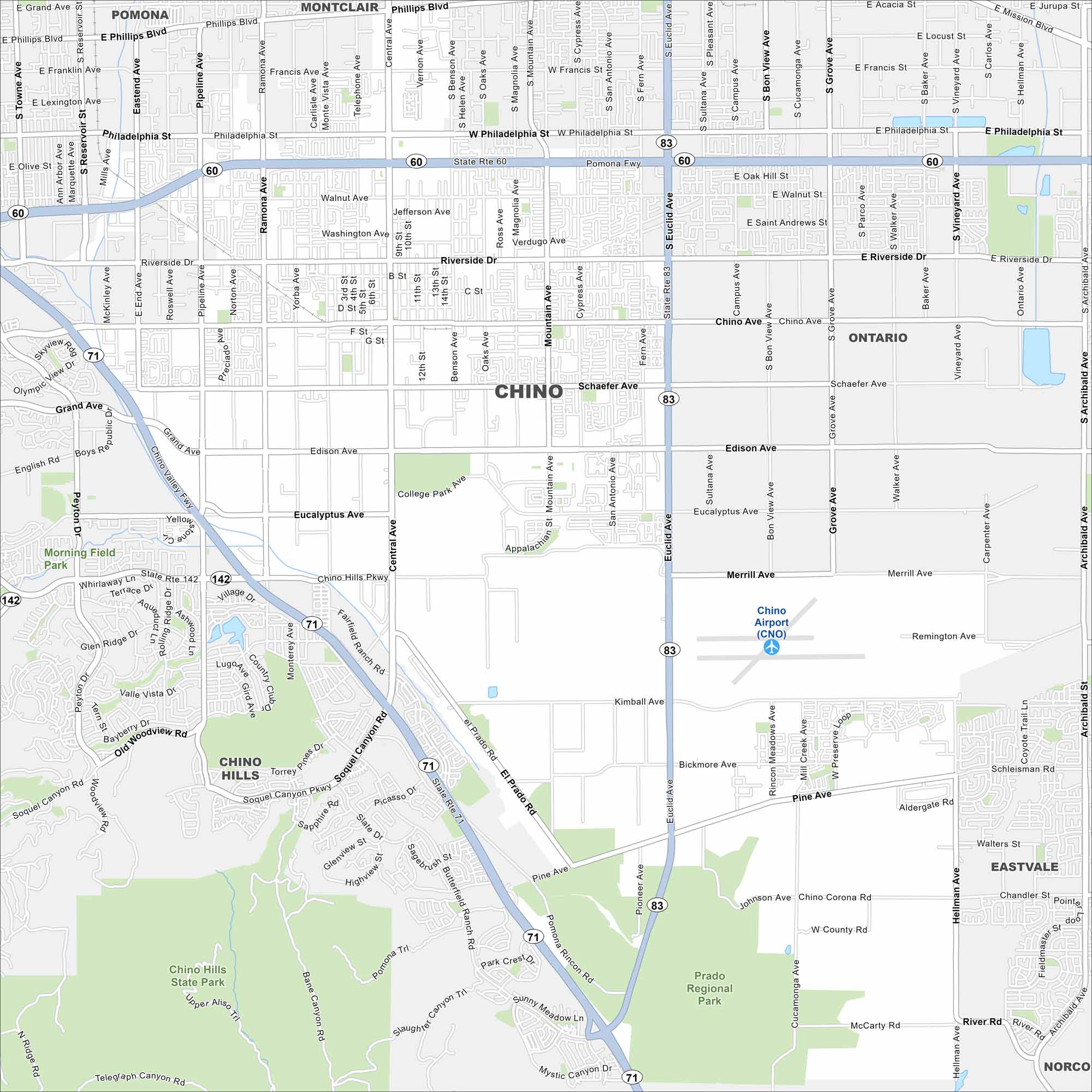
Our map of Chino shows its roads, waterways and airport. Located east of Los Angeles, the city has roots in dairy farming. Wide valleys define much of the landscape.
California State Maps
Explore California with our state maps


Map Information
On the Map
Interstates/Highways: State Rte 60, State Rte 71, State Rte 83, State Rte 142 Major Roads: Central Ave, Riverside Dr, Chino Ave, Schaefer Ave, Edison Ave, Eucalyptus Ave, Merrill Ave, Kimball Ave, Pine Ave, Mountain Ave, Euclid Ave, Benson Ave, Monte Vista Ave, Ramona Ave, Pipeline Ave, Philadelphia St, Phillips Blvd, Yorba Ave, San Antonio Ave, Cypress Ave Airports: Chino Airport (CNO) Parks and Preserves: Chino Hills State Park, Prado Regional Park Nearby Communities: Pomona, Montclair, Ontario, Eastvale, Norco, Chino HillsCalifornia City Maps
Here are detailed maps of California


