Map of Chico, California
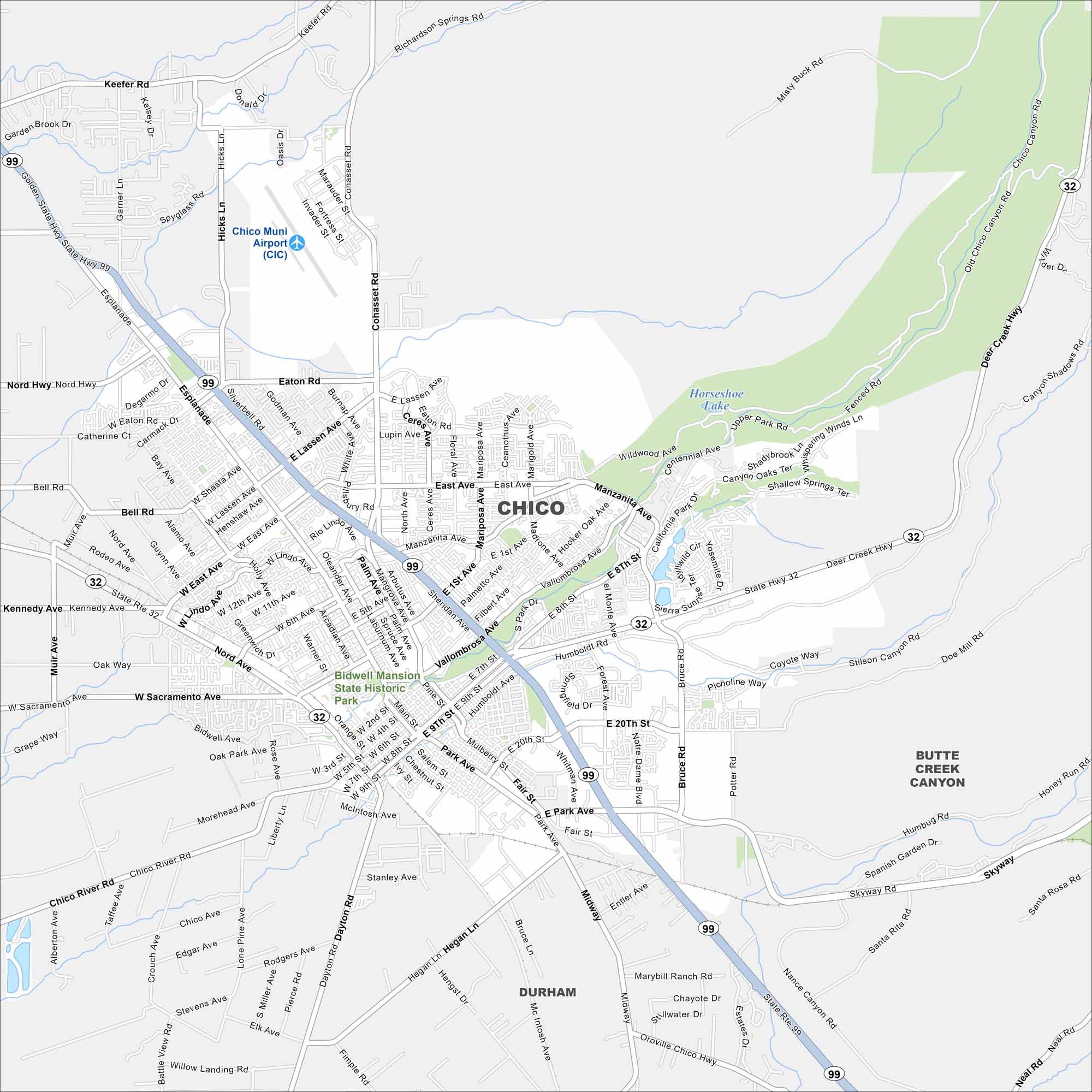
Here’s our map of Chico, California. Our map contains roads, waterways, and the nearby park system. Home to Bidwell Park, it’s one of the largest urban parks in the U.S.
California State Maps
Explore California with our state maps


Map Information
On the Map
Interstates/Highways: State Hwy 99, State Hwy 32 Major Roads: Esplanade, Eaton Rd, Lassen Ave, East Ave, Mangrove Ave, Cohasset Rd, Vallombrosa Ave, Park Ave, Fair St, Skyway, Main St, Broadway St, 8th St, 9th St, 20th St, Dayton Rd, Midway, Hegan Ln, Bruce Rd, Forest Ave Airports: Chico Muni Airport (CIC) Lakes and Reservoirs: Horseshoe Lake Parks and Preserves: Bidwell Mansion State Historic Park Nearby Communities: DurhamCalifornia City Maps
Here are detailed maps of California


