Map of Cathedral City, California
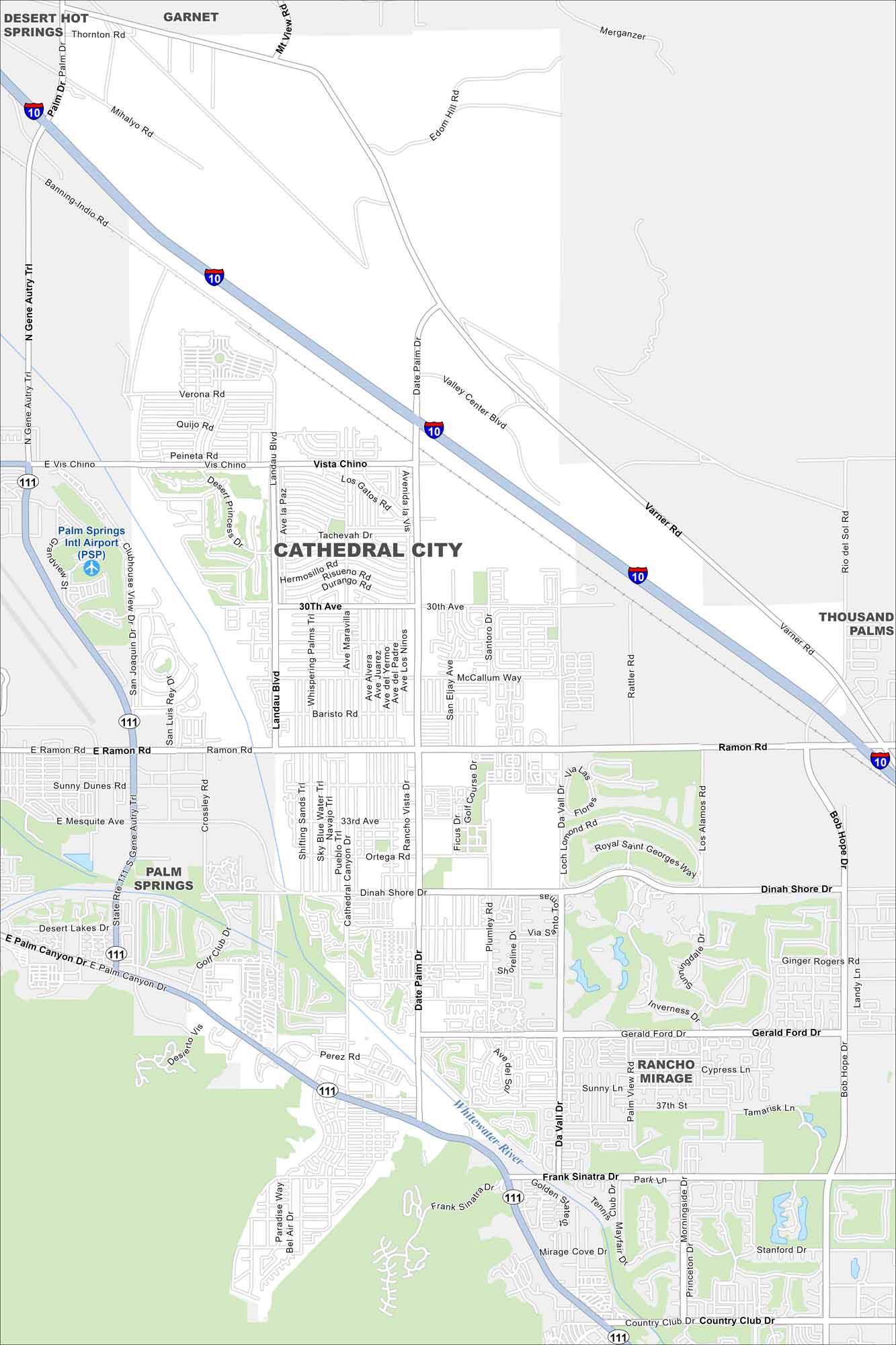
Our map of Cathedral City highlights desert streets and surrounding mountains. It sits in the Coachella Valley between Palm Springs and Rancho Mirage. The desert setting is stark, but the community still feels lively.
California State Maps
Explore California with our state maps


Map Information
On the Map
Interstates/Highways: I-10, State Rte 111 Major Roads: Ramon Rd, Date Palm Dr, Vista Chino, 30th Ave, Landau Blvd, Dinah Shore Dr, Gerald Ford Dr, Frank Sinatra Dr, Da Vall Dr, Varner Rd, Los Gatos Rd, Avenida La Vis, San Eljay Ave, Santoro Dr, McCallum Way, Rattler Rd, Perez Rd, San Luis Rey Dr, Clubhouse View Dr, Desert Princess Dr Airports: Palm Springs Intl Airport (PSP) Major Rivers: Whitewater River Nearby Communities: Desert Hot Springs, Garnet, Palm Springs, Rancho Mirage, Thousand PalmsCalifornia City Maps
Here are detailed maps of California


