Hawaii Volcanoes National Park Map
Hawaii Volcanoes National Park sits on the Big Island. Our park map shows roads, trails, overlooks, and the Mauna Loa Lookout.
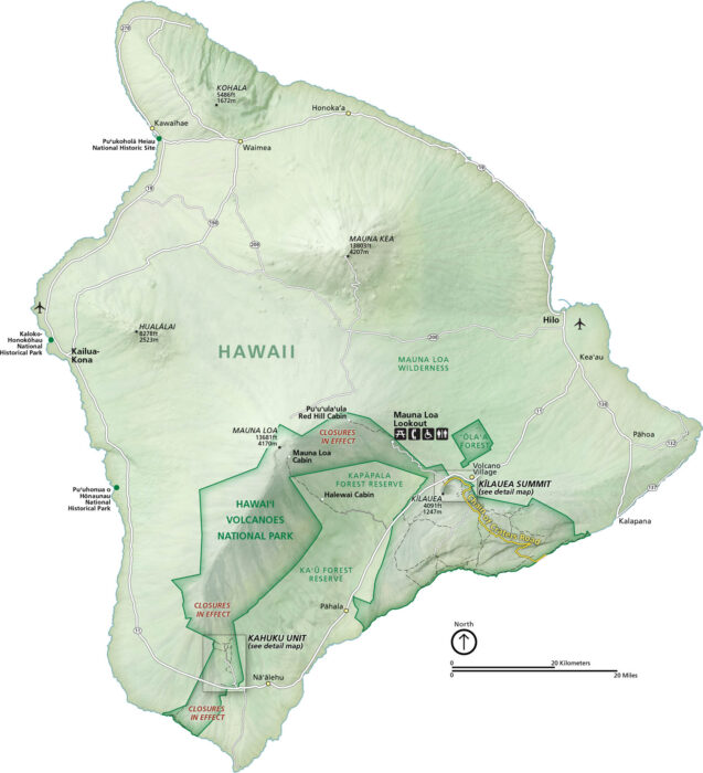
Hawaii Volcanoes National Park sits on the Big Island. Our park map shows roads, trails, overlooks, and the Mauna Loa Lookout.
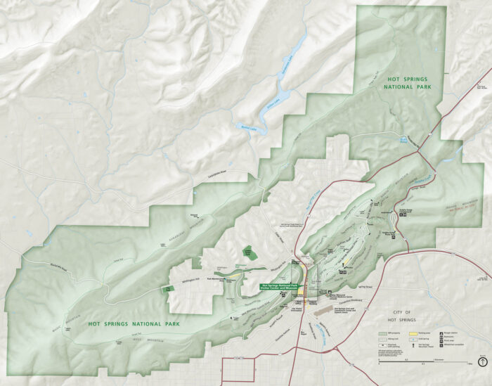
Set in central Arkansas, Hot Springs National Park wraps around Bathhouse Row, forested hills, and the warm waters that made the city famous.
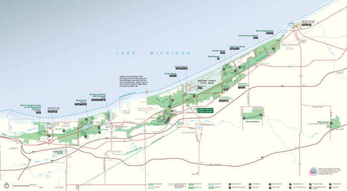
Indiana Dunes National Park unfolds along Lake Michigan. Our map shows everything from trails and beaches to roads and parking areas.
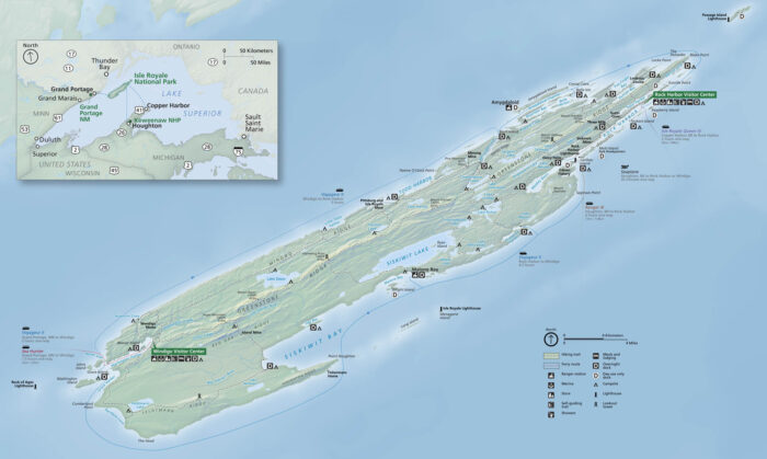
On our map of Isle Royale National Park, you’ll find ferry landings, trails, lakes campgrounds, and much more.
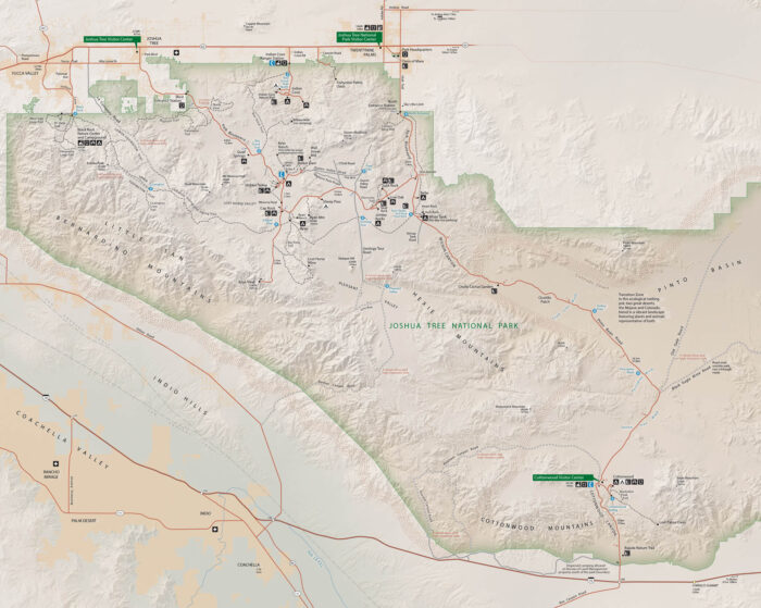
Our Joshua Tree National Park map shows roads, trails, campgrounds and much more. Set in southern California, get familiar with it.
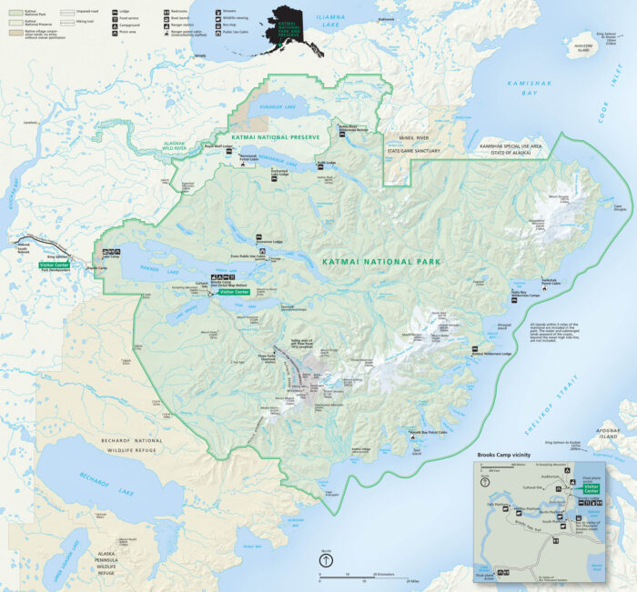
Our map of Katmai National Park guides you through Alaska’s wild volcanic country. The park holds the Valley of Ten Thousand Smokes.
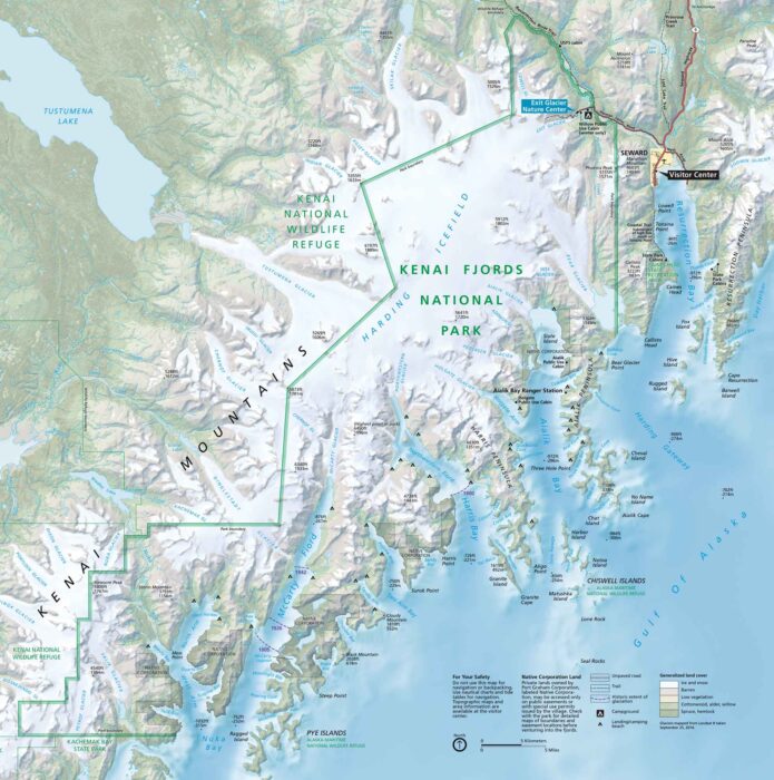
Kenai Fjords National Park hugs Alaska’s southern coast, filled with fjords. Our map shows trails, waterways, visitor centers and campgrounds.
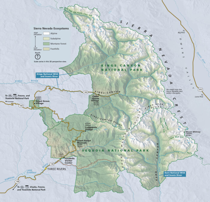
Kings Canyon National Park carves deep into the Sierra Nevada. Located in central California, the park has cliffs, forests and valleys.
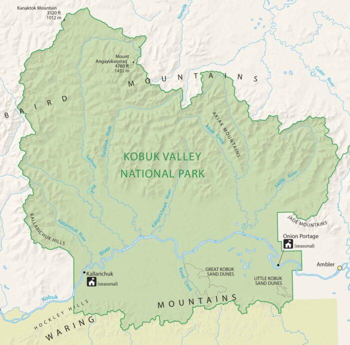
Kobuk Valley National Park’s vast tundra stretches endlessly here. Our park map highlights seasonal ranger stations, sand dunes and rivers.
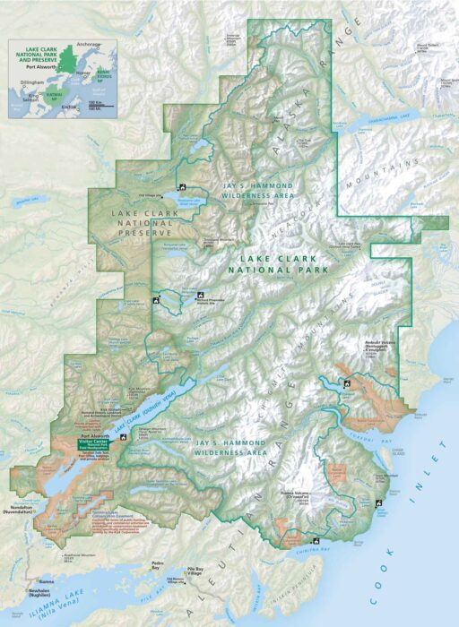
Discover wild Alaska like never before. Our Lake Clark National Park map shows trails, waterways, campgrounds, and everything you need.
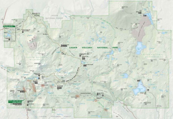
Located in northern California, Lassen Volcanic National Park is full of geothermal life. Our park map displays its roads, trails, and more.
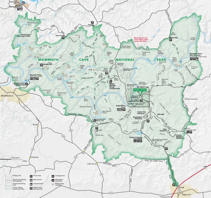
Our map of Mammoth Cave National Park shows trails, campsites and roads. Located in central Kentucky, this park has the longest cave system.
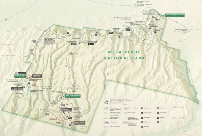
Set in southwestern Colorado, our Mesa Verde National Park map shows roads, trails, overlooks, campgrounds and more.
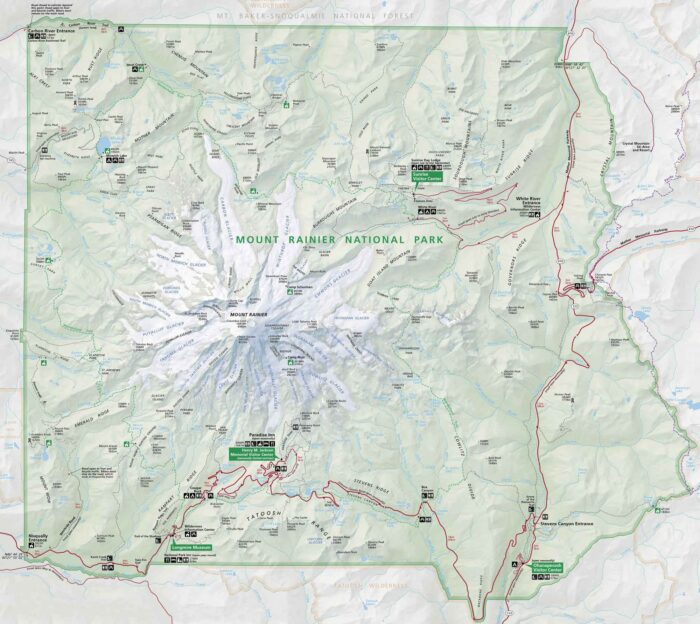
Mount Rainier National Park towers with its sheer presence. Our park map shows roads, trails, viewpoints, visitor centers, and glaciers.
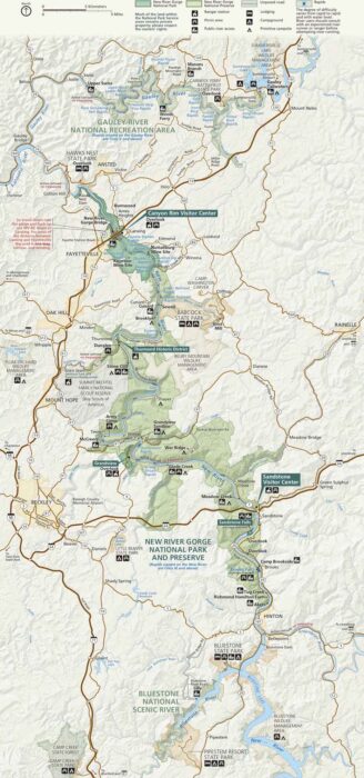
Adventure starts in this carved-out canyon. Our New River Gorge National Park map marks roads, trails, campgrounds, and scenic pull-offs.