Kings Canyon National Park Map
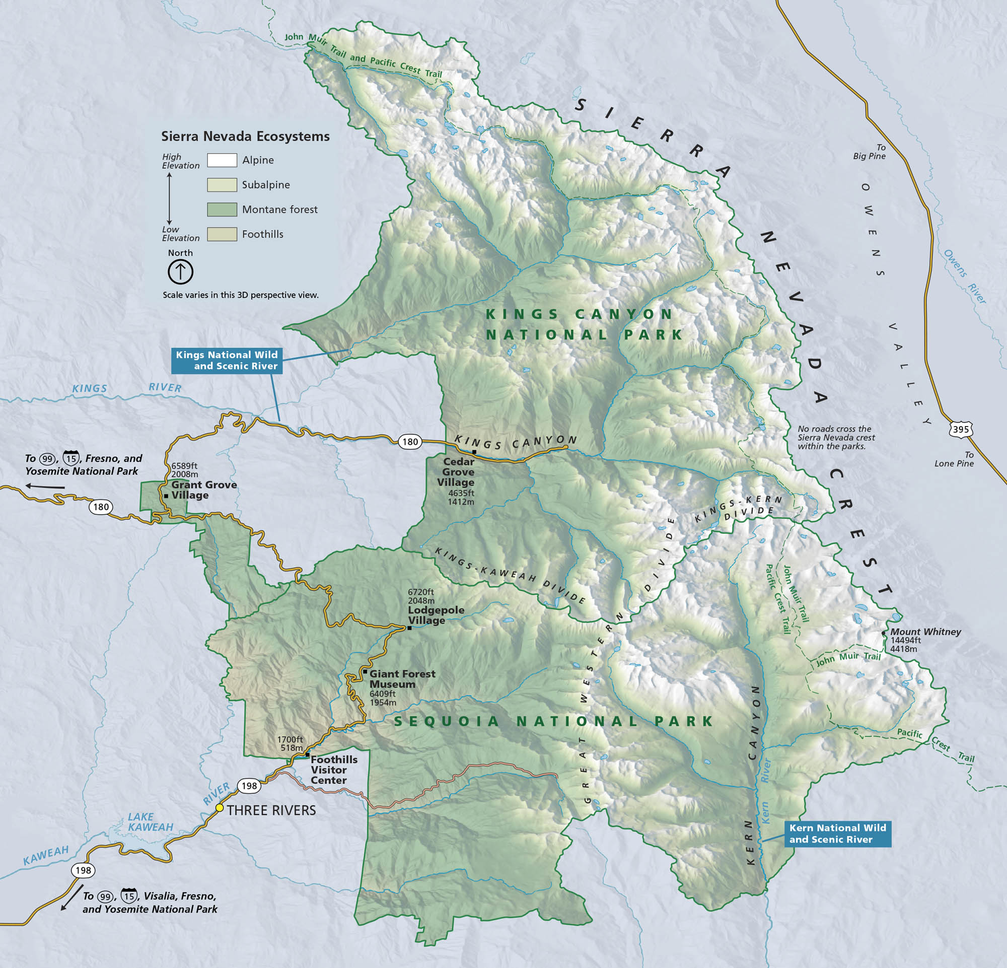
Kings Canyon National Park carves deep into the Sierra Nevada. Located in central California, the park has cliffs, forests, high mountain passes, and glacial valleys. Our map lays out roads, rivers and its ecosystem.
Map Information
On the Map
Interstates/Highways: US Hwy 395 Major Roads: State Rte 180, State Rte 198 Rivers/Lakes: Kings River, South Fork Kings River, Middle Fork Kings River, Kern River, Kaweah River, Lake Kaweah Parks: Kings Canyon National Park, Sequoia National Park Visitor Centers: Foothills Visitor Center, Giant Forest Museum Cities/Towns: Three Rivers, Fresno, Visalia, Big Pine, Lone Pine Park Sites: Grant Grove Village, Cedar Grove Village, Lodgepole Village, Giant Forest Other Landmarks: Sierra Nevada Crest, Kings-Kern Divide, Kings-Kaweah Divide, Great Western Divide, Mount Whitney, John Muir Trail, Pacific Crest Trail, Owens ValleyNational Park Maps
Find maps of green spaces and national parks near you.


