Mesa Verde National Park Map
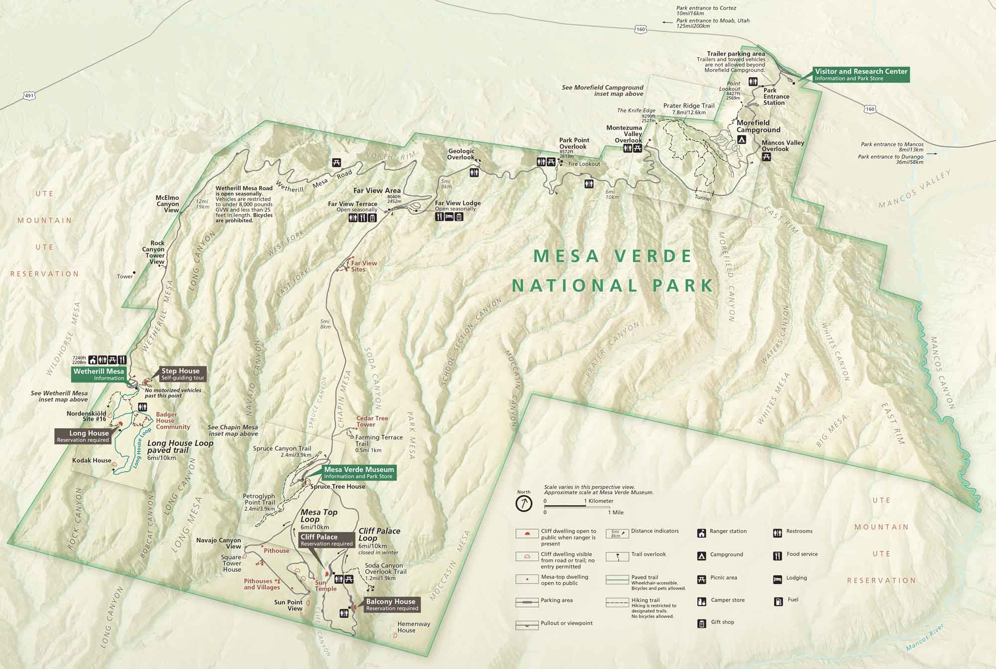
Set in southwestern Colorado, Mesa Verde National Park contains ancient cliff dwellings, deep canyons, and quiet high-desert vistas. Our park map shows roads, trails, overlooks, campgrounds and more.
Map Information
On the Map
Parks: Ute Mountain Reservation Visitor Centers: Visitor and Research Center, Mesa Verde Museum, Wetherill Mesa Information Major Roads: US Hwy 160, Wetherill Mesa Rd, Cliff Palace Loop, Mesa Top Loop, Sun Point Dr Rivers: Mancos River Cities/Towns: Cortez, Moab, Durango, Mancos Campgrounds/Park Sites: Morefield Campground, Far View Lodge, Far View Terrace Other Landmarks: Cliff Palace, Balcony House, Spruce Tree House, Long House, Step House, Square Tower House, Sun Temple, Pithouses, Point Lookout, Park Point, Knife Edge, Geologic OverlookNational Park Maps
Find maps of green spaces and national parks near you.


