Hawaii Volcanoes National Park Map
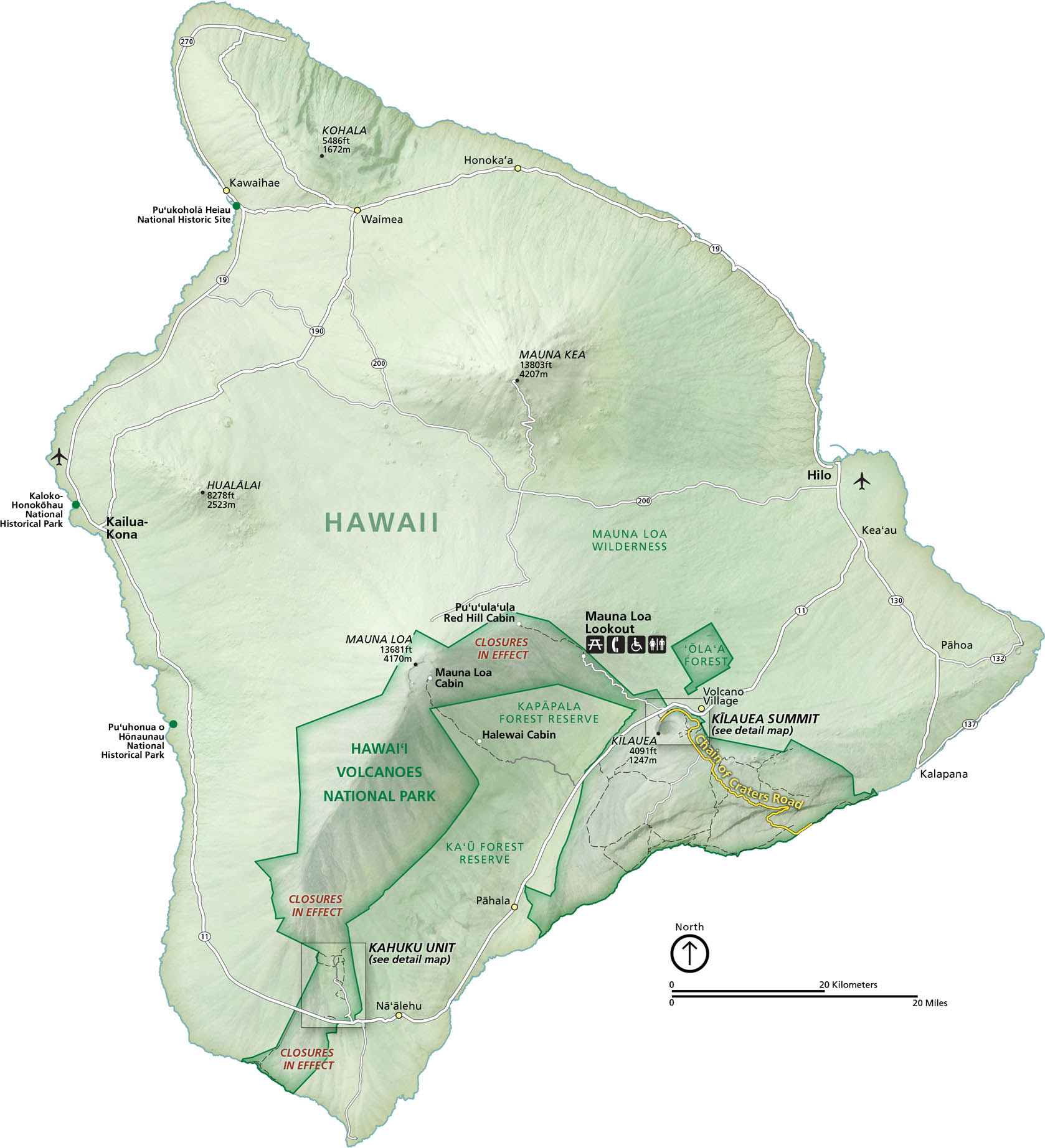
Hawaii Volcanoes National Park sits on the Big Island. Its landscape is mostly craters, forests, and lava fields. Our park map shows roads, trails, overlooks, and the Mauna Loa Lookout.
Map Information
On the Map
Highways: State Rte 11, State Rte 19, State Rte 130, State Rte 190, State Rte 200, State Rte 270 Major Roads: Chain of Craters Rd, Mauna Loa Rd, Crater Rim Drive Bays/Oceans: Pacific Ocean, Hilo Bay, Kawaihae Bay, Kealakekua Bay Parks: Hawaiʻi Volcanoes National Park, Mauna Loa Wilderness, Kapapala Forest Reserve, Ka’u Forest Reserve, Ola’a Forest, Puʻuhonua o Hōnaunau National Historical Park, Kaloko-Honokōhau National Historical Park, Puʻukoholā Heiau National Historic Site Visitor Centers: Kīlauea Visitor Center Cities/Towns: Hilo, Kailua-Kona, Volcano Village, Pahoa, Na’alehu, Pahala, Waimea, Honoka’a Campgrounds/Park Sites: Mauna Loa Cabin, Red Hill Cabin, Pu’u’ula’ula, Halewai Cabin, Namakanipaio Campground, Kulanaokuaiki Campground, Kahuku Unit Other Landmarks: Kīlauea Summit, Mauna Loa, Mauna Kea, Hualālai, Kohala, Mauna Loa LookoutNational Park Maps
Find maps of green spaces and national parks near you.


