US Election 1896 Map
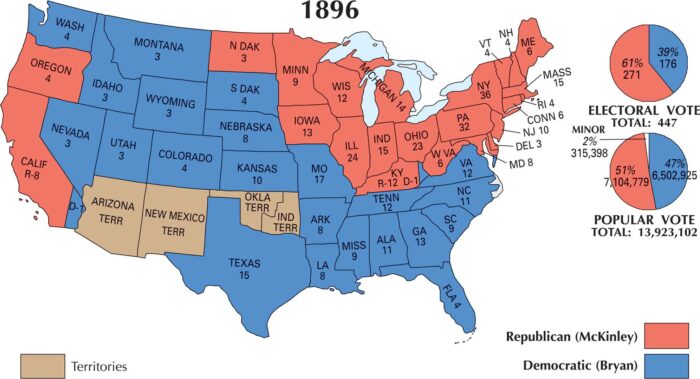
William McKinley won the 1896 election. This map shows McKinley strong in the Northeast, Midwest, and parts of the West.
William McKinley won the 1896 election. This map shows McKinley strong in the Northeast, Midwest, and parts of the West.
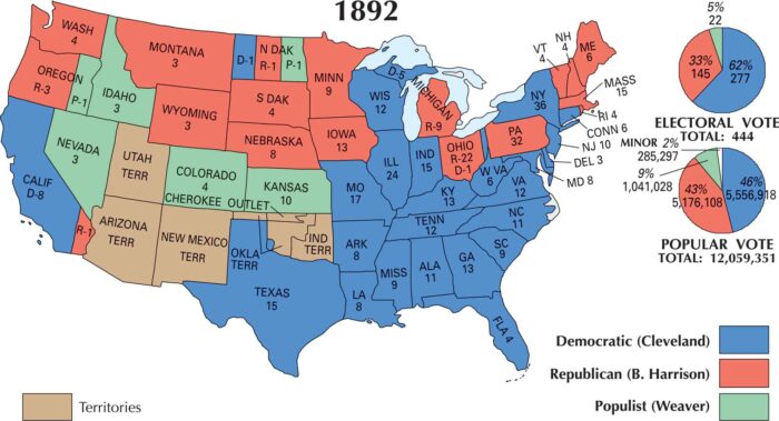
Our US election map of 1892 shows how Cleveland carried most of the South and parts of the Midwest. He defeated the Republicans and Populists.
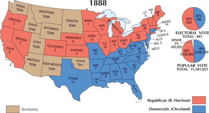
Our 1888 US election map shows Harrison carried most of the North and Midwest. Cleveland swept the South and parts of the border states.
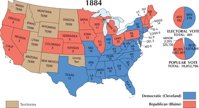
The 1884 US election was a close contest. Our map displays Democrat Grover Cleveland narrowly defeating Republican James G. Blaine.
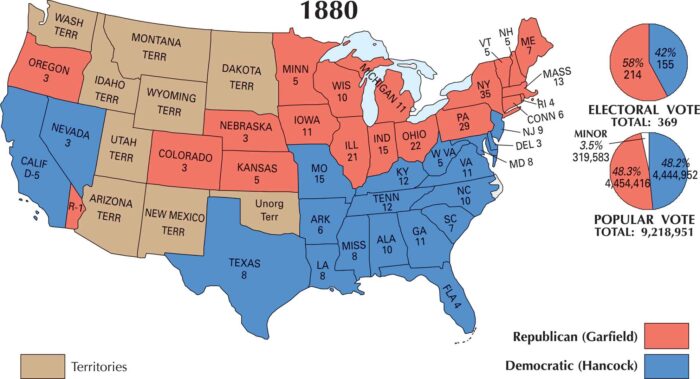
Our 1880 US election maps shows Republican James A. Garfield as the winner. It was one of the narrowest margins in US election history.
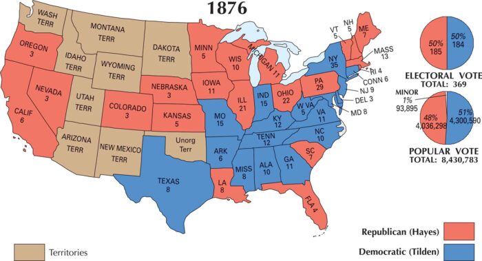
Our map shows the US 1876 election as razor-thin. Rutherford B. Hayes, the Republican, narrowly defeated Democrat Samuel J. Tilden.
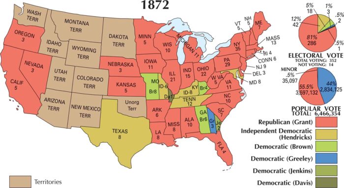
In 1872, Ulysses S. Grant easily won re-election, sweeping nearly the entire country. His Republican support stretched across the U.S.
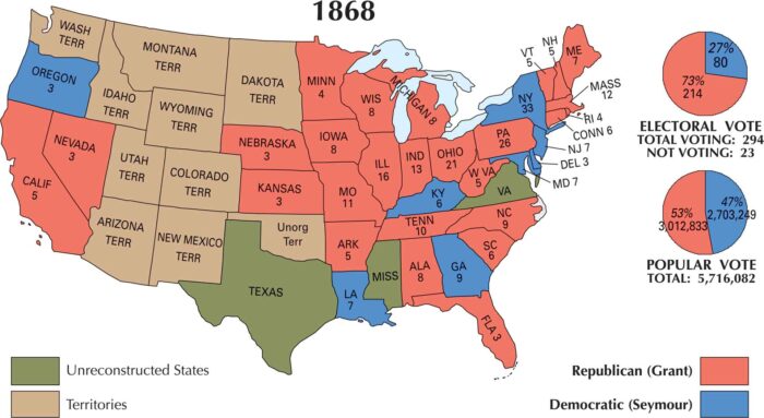
Our map of the 1868 US election shows Ulysses S. Grant’s victory. But the nation was still being stitched together after the Civil War.
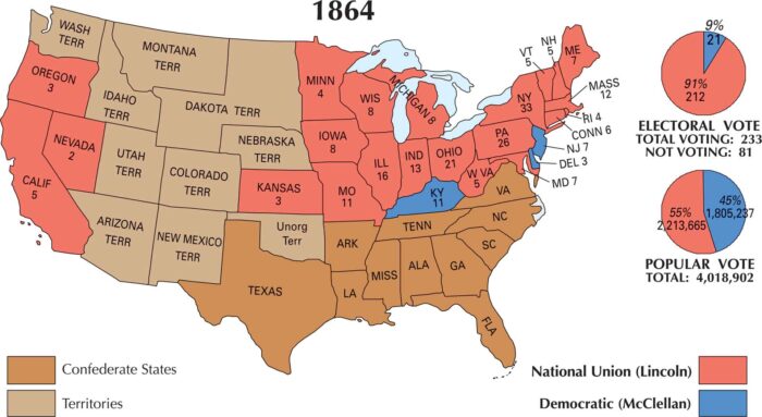
The US 1864 election was at war with itself without Confederate states. Abraham Lincoln’s re-election came as the Civil War neared its end.
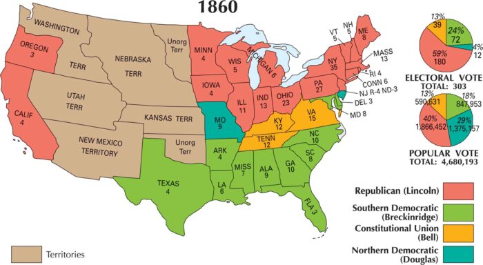
Our map of the 1860 election shows a division that is impossible to miss. When all the dust settled, Abraham Lincoln won the US 1860 election.
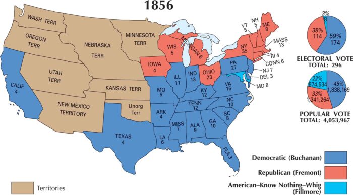
If you look at this map of the 1856 election, it looks fairly split apart. In the end, the Democratic Party defeated the Republicans.
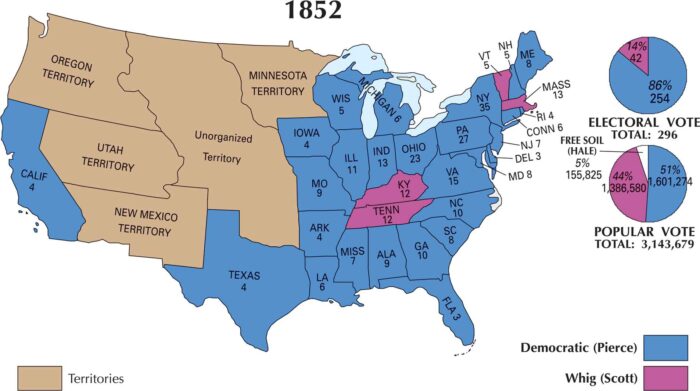
The map of the 1852 election looks calmer than it really was. Blue stretches across nearly every state. But the old Whig Party was collapsing.
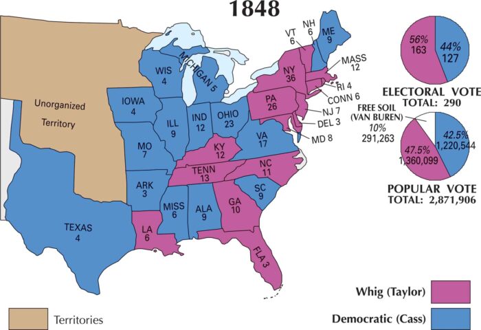
This map of the US 1848 election shows a country divided. Zachary Taylor’s Whig support spreads across the South and much of the West.
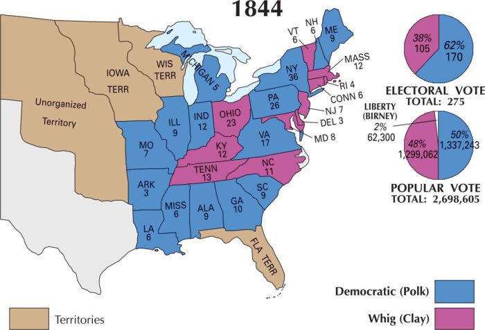
Our US election 1844 map shows how sharply divided the nation had become between James K. Polk (Democratic) and Henry Clay (Whig Party).
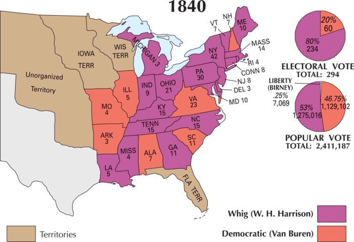
Our 1840 US election map shows Harrison’s support in the North, the West, and the Mid-Atlantic. Van Buren held on mainly in the South.