Map of Carlsbad, California
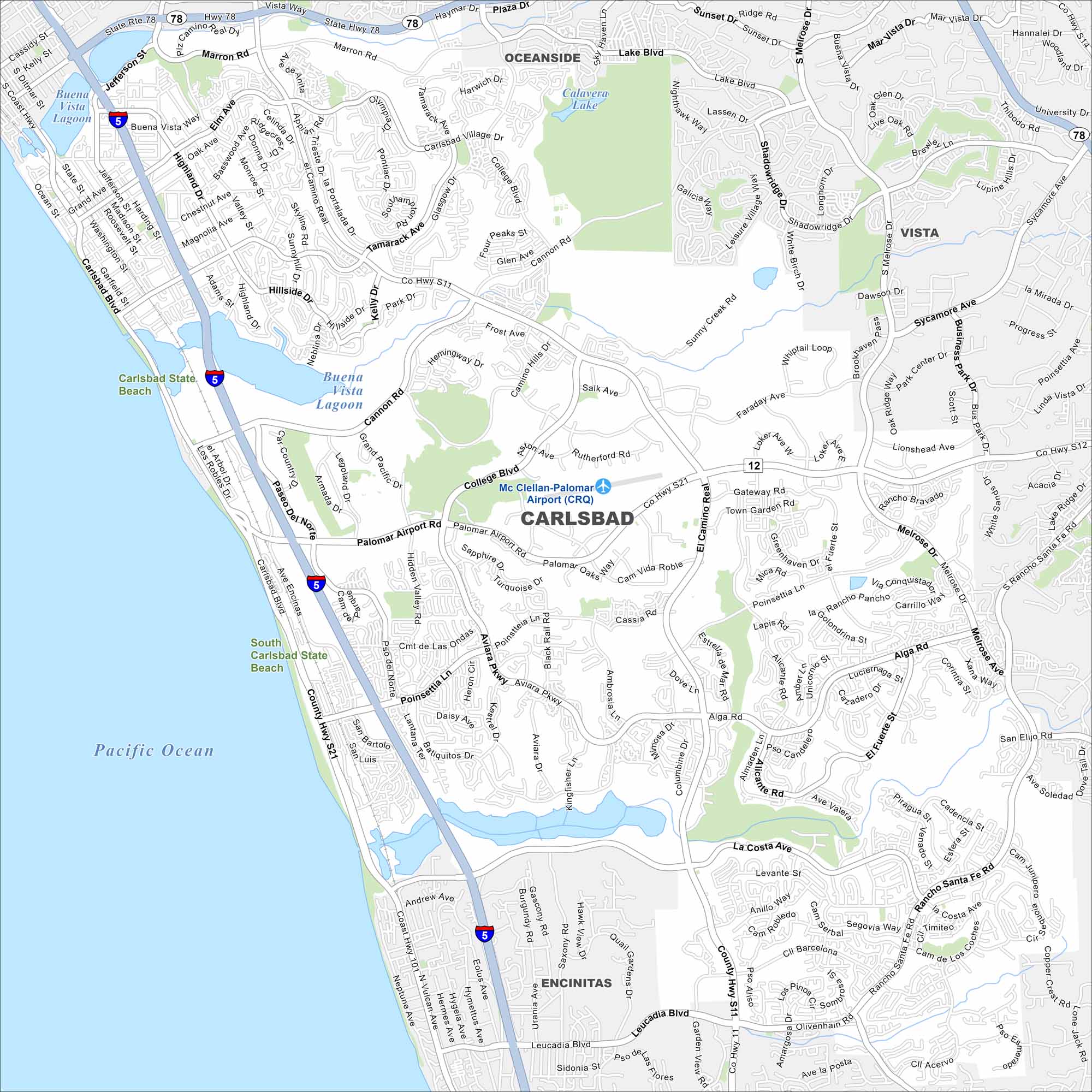
Carlsbad is a coastal city north of San Diego. Our map shows beaches, lagoons, and neighborhoods near the Pacific Ocean. It’s known as “The Village by the Sea” because of its seaside location.
California State Maps
Explore California with our state maps


Map Information
On the Map
Interstates/Highways: I-5, State Hwy 78, U.S. Hwy 101 Major Roads: Carlsbad Blvd, El Camino Real, Palomar Airport Rd, Cannon Rd, Carlsbad Village Dr, Poinsettia Ln, Melrose Dr, La Costa Ave, Rancho Santa Fe Rd, Leucadia Blvd, Alga Rd, College Blvd, Aviara Pkwy, Tamarack Ave, Jefferson St, Marron Rd, Plaza Dr, Vista Way, Oceanside Blvd, S Melrose Dr Airports: Mc Clellan-Palomar Airport (CRQ) Lakes and Reservoirs: Calavera Lake, Buena Vista Lagoon, Batiquitos Lagoon, Agua Hedionda Lagoon, Pacific Ocean Parks and Preserves: Carlsbad State Beach, South Carlsbad State Beach Nearby Communities: Oceanside, Vista, EncinitasCalifornia City Maps
Here are detailed maps of California


