Map of Camden, New Jersey
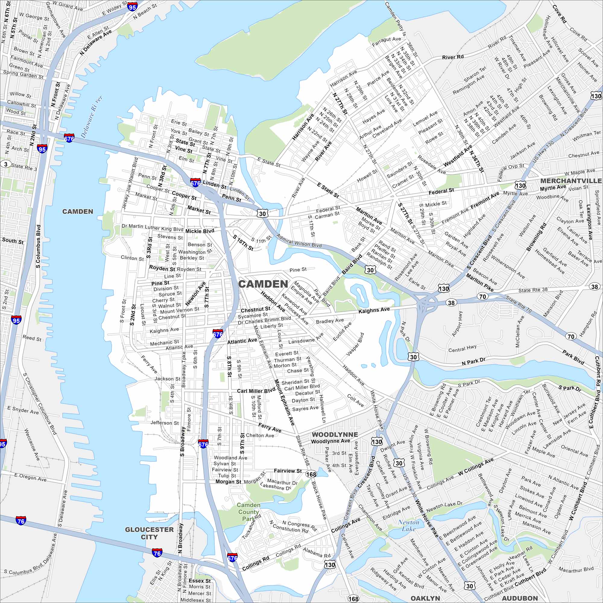
Camden is on the Delaware River across from Philadelphia. Our map shows the waterfront, roads, and major bridges. The city is often linked to shipping and industry with port access.
Map Information
On the Map
Interstates/Highways: I-676, I-95, I-76, US Hwy 130, State Rte 38, State Rte 70, State Rte 168 Major Roads: Admiral Wilson Blvd, Federal St, Market St, Mickle Blvd, Haddon Ave, Mt Ephraim Ave, Broadway, Martin Luther King Blvd, Kaighns Ave, Atlantic Ave, Ferry Ave, Collings Ave, Westfield Ave, Marlton Pike, River Rd, Crescent Blvd, Central Hwy, White Horse Pike, Black Horse Pike, Park Blvd Lakes and Reservoirs: Newton Lake Major Rivers: Delaware River Parks and Preserves: Camden County Park Nearby Communities: Merchantville, Woodlynne, Gloucester City, Oaklyn, AudubonNew Jersey State Maps
Explore maps from the Garden State.


City Maps of New Jersey
Newark and New Jersey cities in complete detail


