Map of Camarillo, California
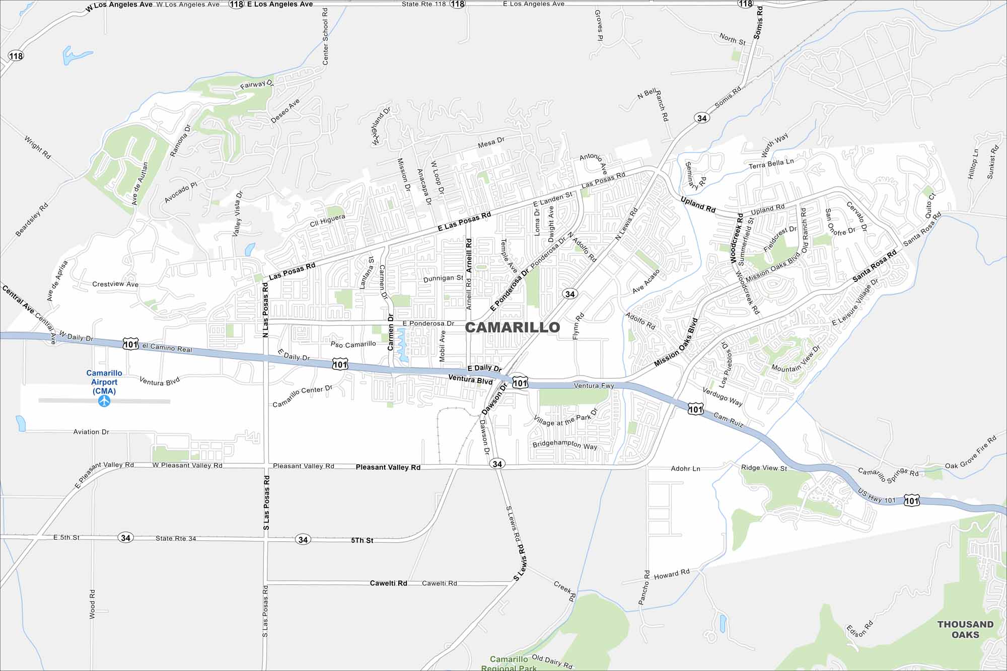
Check out Camarillo with our road map. The city sits between the Santa Monica Mountains and the Pacific Ocean. It’s known for agriculture but hills frame its backdrop.
California State Maps
Explore California with our state maps


Map Information
On the Map
Interstates/Highways: U.S. Hwy 101, State Rte 118, Ventura Fwy Major Roads: Las Posas Rd, Pleasant Valley Rd, Daily Dr, Ventura Blvd, Ponderosa Dr, Santa Rosa Rd, Los Angeles Ave, Adolfo Rd, Mission Oaks Blvd, Lewis Rd, Carmen Dr, Arneill Rd, Dawson Rd, Cawelti Rd, Wood Rd, Wright Rd, Beardsley Rd, Somis Rd, Upland Rd, Flynn Rd Airports: Camarillo Airport (CMA) Nearby Communities: Thousand OaksCalifornia City Maps
Here are detailed maps of California


