Map of Caledonia, Wisconsin
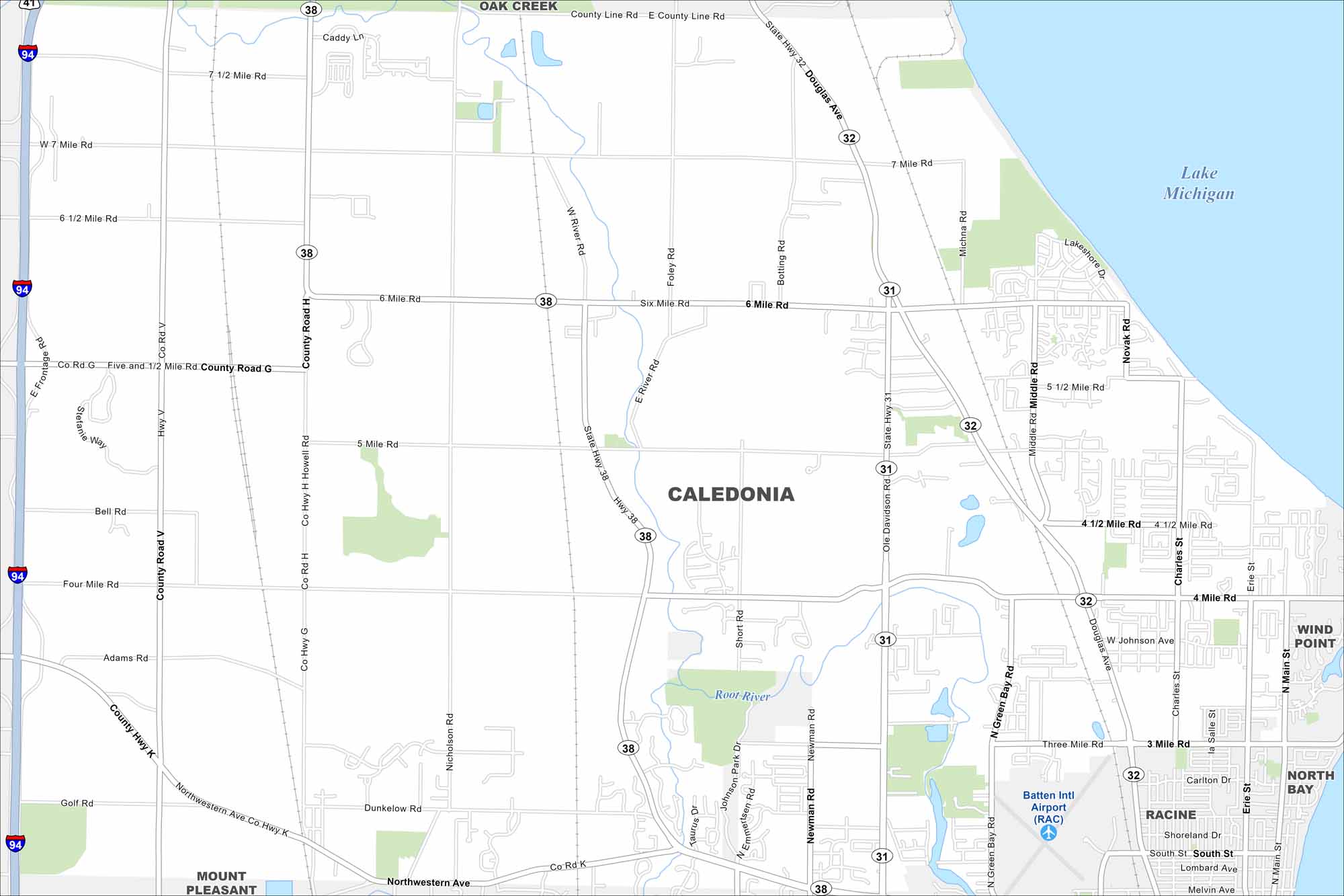
Caledonia is in southeastern Wisconsin along Lake Michigan. Our map shows rural stretches, highways, and its long shoreline. The lakefront adds to its character.
Map Information
On the Map
Interstates/Highways: I-94, State Rte 38, State Rte 32, State Rte 31 Major Roads: 7 Mile Rd, 6 Mile Rd, 5 Mile Rd, 4 Mile Rd, 3 Mile Rd, Northwestern Ave, Douglas Ave, Michna Rd, Green Bay Rd, County Road H, County Road K, County Road G, 6 1/2 Mile Rd, 7 1/2 Mile Rd, Nicholson Rd, Erie St, Charles St, Novak Rd, Batten Rd, Main St Airports: Batten Intl Airport Lakes and Reservoirs: Lake Michigan Major Rivers: Root River Nearby Communities: Oak Creek, Wind Point, North Bay, Racine, Mount PleasantWisconsin State Maps
Discover maps of the Badger State.


City Maps of Wisconsin
See our Wisconsin maps designed for clarity.


