Map of Burlingame, California
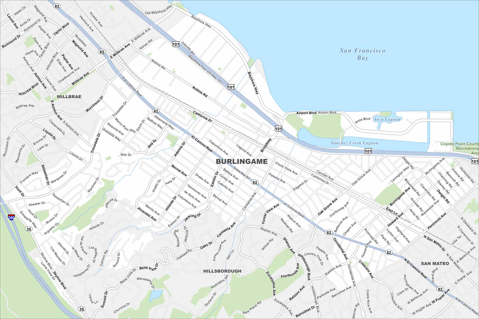
Our map of Burlingame shows its waterfront along San Francisco Bay. You’ll find highways, rivers, lakes and green spaces. The city is known for its strong ties to aviation.
California State Maps
Explore California with our state maps


Map Information
On the Map
Interstates/Highways: I-280, U.S. Hwy 101, State Rte 82, State Rte 35 Major Roads: El Camino Real, California Dr, Broadway, Peninsula Ave, Trousdale Dr, Millbrae Ave, Rollins Rd, Hillside Dr, Skyline Blvd, Oak Grove Ave, Howard Ave, Adeline Dr, Sanchez Ave, Magnolia Ave, Carolan Ave, Easton Dr, Marco Polo Way, Sebastian Dr, Murchison Dr, Ray Dr Lakes and Reservoirs: San Francisco Bay, Anza Lagoon, Sanchez Creek Lagoon Parks and Preserves: Coyote Point County Recreational Area Nearby Communities: Millbrae, Hillsborough, San MateoCalifornia City Maps
Here are detailed maps of California


