Map of Burbank, California
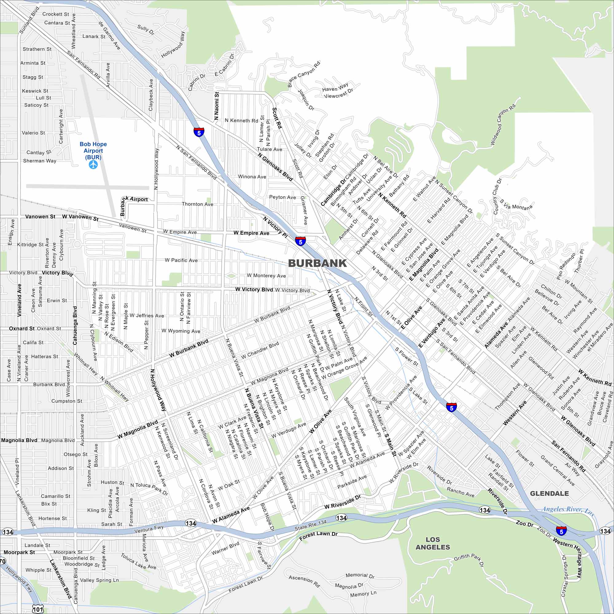
Burbank is in the San Fernando Valley, bordered by the Verdugo Mountains. Our map shows major routes and connections to nearby Los Angeles.
California State Maps
Explore California with our state maps


Map Information
On the Map
Interstates/Highways: I-5, State Rte 134, State Rte 170 Major Roads: Victory Blvd, Burbank Blvd, Magnolia Blvd, Olive Ave, Hollywood Way, Glenoaks Blvd, Alameda Ave, Riverside Dr, San Fernando Blvd, Verdugo Ave, Buena Vista St, Vanowen St, Empire Ave, Thornton Ave, Pacific Ave, Monterey Ave, Chandler Blvd, Oak St, Western Ave, Scott Rd Airports: Bob Hope Airport (BUR) Major Rivers: Los Angeles River Parks and Preserves: Griffith Park, Wildwood Canyon Park Nearby Communities: Glendale, Los AngelesCalifornia City Maps
Here are detailed maps of California


